MyTopo
Meeker Oklahoma US Topo Map
Couldn't load pickup availability
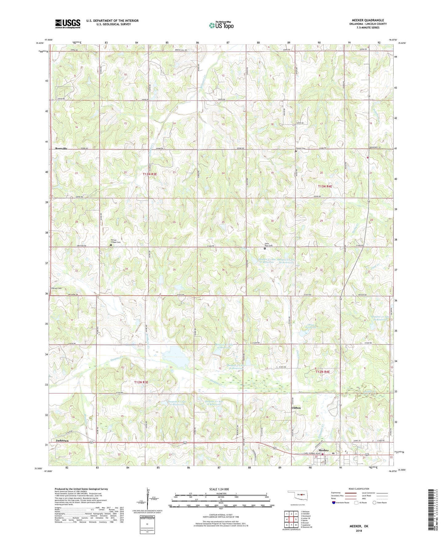
2022 topographic map quadrangle Meeker in the state of Oklahoma. Scale: 1:24000. Based on the newly updated USGS 7.5' US Topo map series, this map is in the following counties: Lincoln. The map contains contour data, water features, and other items you are used to seeing on USGS maps, but also has updated roads and other features. This is the next generation of topographic maps. Printed on high-quality waterproof paper with UV fade-resistant inks.
Quads adjacent to this one:
West: Luther SE
Northwest: Wellston
North: Chandler
Northeast: Davenport
East: Sparks
Southeast: Shawnee NE
South: Aydelotte
Southwest: McLoud
This map covers the same area as the classic USGS quad with code o35096e8.
Contains the following named places: Brush Creek, Central Lincoln County Fire Protection District 4 Station 2, Clifton, Coon Creek, Forest Cemetery, Forest Church, Horton Chapel Cemetery, Hortons Chapel, Meeker, Meeker Division, Meeker Fire Department, Meeker High School, Meeker Middle School, Meeker Police Department, Meeker Post Office, Morning Star Church, Oknoname 08102 Dam, Oknoname 08102 Reservoir, Quapaw Creek Site 16 Dam, Quapaw Creek Site 16 Reservoir, Quapaw Creek Site 17 Dam, Quapaw Creek Site 17 Reservoir, Quapaw Creek Site 31 Dam, Quapaw Creek Site 31 Reservoir, Quapaw Creek Site 33 Dam, Quapaw Creek Site 33 Reservoir, Quapaw Creek Site 34 Dam, Quapaw Creek Site 34 Reservoir, Quapaw Creek Site 35 Dam, Quapaw Creek Site 35 Reservoir, Quapaw Creek Site 36 Dam, Quapaw Creek Site 36 Reservoir, Quapaw Creek Site 37 Dam, Quapaw Creek Site 37 Reservoir, Quapaw Creek Site 38 Dam, Quapaw Creek Site 38 Reservoir, Quapaw Creek Site 39 Dam, Quapaw Creek Site 39 Reservoir, Rossville, Saint Paul Cemetery, Saint Paul Church, South Quapaw Creek, Township of North Choctaw, Township of North Wichita, Township of South Choctaw, Township of South Wichita, Wildhorse Creek, ZIP Code: 74855