MyTopo
Chandler Oklahoma US Topo Map
Couldn't load pickup availability
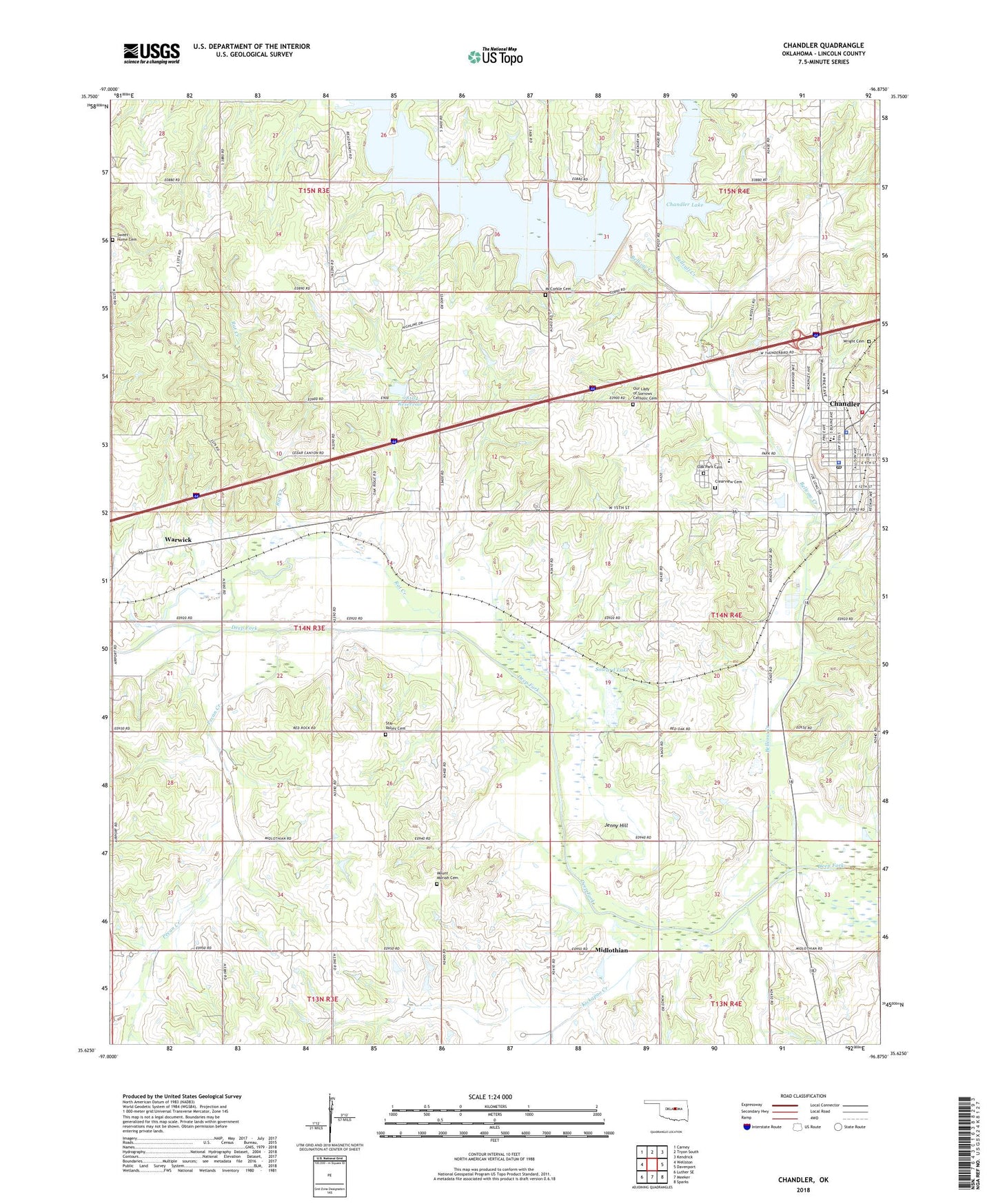
2018 topographic map quadrangle Chandler in the state of Oklahoma. Scale: 1:24000. Based on the newly updated USGS 7.5' US Topo map series, this map is in the following counties: Lincoln. The map contains contour data, water features, and other items you are used to seeing on USGS maps, but also has updated roads and other features. This is the next generation of topographic maps. Printed on high-quality waterproof paper with UV fade-resistant inks.
Quads adjacent to this one:
West: Wellston
Northwest: Carney
North: Tryon South
Northeast: Kendrick
East: Davenport
Southeast: Sparks
South: Meeker
Southwest: Luther SE
Contains the following named places: Bell Cow Lake, Bellcalf Creek, Bellcow Creek, Chandler, Chandler Ambulance, Chandler Camp, Chandler Dam, Chandler Fire Department Station 1, Chandler High School, Chandler Junior High School, Chandler Lake, Chandler Police Department, Chandler Post Office, City of Chandler, Clearview Cemetery, East Side Elementary School, First Baptist Church, First Church-Christ Scientist, Indian Spring Park, Jenny Hill, Kickapoo Creek, Lincoln County, Lincoln County Jail, Lincoln County Sheriff, McCorkle Cemetery, Midlothian, Mount Moriah Cemetery, Oak Park Cemetery, Oknoname 08104 Dam, Oknoname 08104 Reservoir, Oknoname 111001 Dam, Oknoname 111001 Reservoir, Otoe Creek, Our Lady of Sorrows Catholic Cemetery, Park Road Elementary School, Pecan Creek, Rat Creek, Soward Lake, Springdale School, Star Valley Cemetery, Sweet Home Cemetery, Sweet Home Church, Township of Chandler, Township of McKinley, United Methodist Church, Wright Cemetery, ZIP Code: 74834