MyTopo
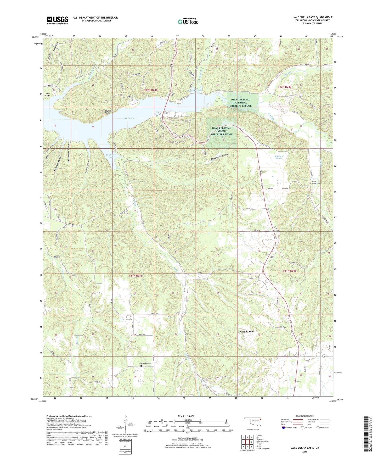
Lake Eucha East Oklahoma US Topo Map
Couldn't load pickup availability
2022 topographic map quadrangle Lake Eucha East in the state of Oklahoma. Scale: 1:24000. Based on the newly updated USGS 7.5' US Topo map series, this map is in the following counties: Delaware. The map contains contour data, water features, and other items you are used to seeing on USGS maps, but also has updated roads and other features. This is the next generation of topographic maps. Printed on high-quality waterproof paper with UV fade-resistant inks.
Quads adjacent to this one:
West: Lake Eucha West
Northwest: Chloeta
North: Jay
Northeast: Sycamore
East: Colcord
Southeast: Siloam Springs NW
South: Kansas
Southwest: Leach
This map covers the same area as the classic USGS quad with code o36094c7.
Contains the following named places: Beaty Creek, Big Beaver Hollow, Black Fox Bluff, Black Fox Cemetery, Brush Creek, Brush Creek Bay, Cloud Creek, Cloud Creek Census Designated Place, Clouds Creek Cemetery, Coleman Hollow, Dry Creek, Dry Creek Arm, Dry Creek Church, Elkhorn Prairie, Lake Eucha, Lake Eucha State Park, Lanes Bluff, Little Beaver Hollow, Lone Prairie Lookout Tower, New Green Church, Rattlesnake Creek, Runaway Hollow, Teesquatnee Hollow, Tyio-Dry Creek, Upper Spavinaw Recreation Area