MyTopo
Dunbar Oklahoma US Topo Map
Couldn't load pickup availability
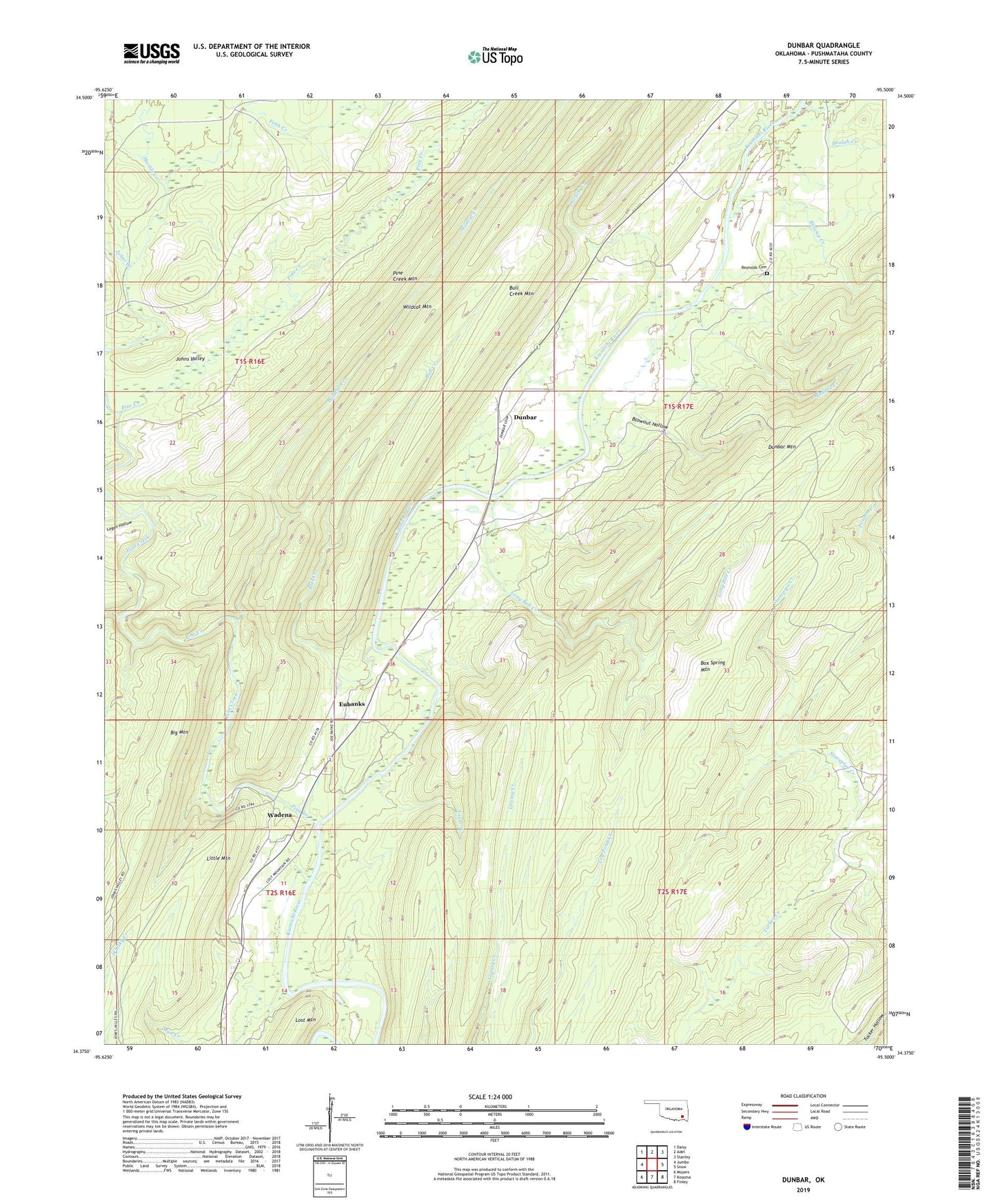
2019 topographic map quadrangle Dunbar in the state of Oklahoma. Scale: 1:24000. Based on the newly updated USGS 7.5' US Topo map series, this map is in the following counties: Pushmataha. The map contains contour data, water features, and other items you are used to seeing on USGS maps, but also has updated roads and other features. This is the next generation of topographic maps. Printed on high-quality waterproof paper with UV fade-resistant inks.
Quads adjacent to this one:
West: Jumbo
Northwest: Daisy
North: Adel
Northeast: Stanley
East: Snow
Southeast: Finley
South: Kosoma
Southwest: Moyers
Contains the following named places: Beulah Creek, Big Mountain, Blowout Hollow, Blowup Creek, Box Spring Mountain, Bull Creek, Bull Creek Mountain, Dunbar, Eubanks, Fobb Creek, Hackett Creek, Johns Creek, Johns Valley, Little Mountain, Logan Hollow, Long Bell Creek, Lost Mountain, Maddox Creek, Marble Creek, Monkeywrench Creek, Mud Creek, Pine Creek, Reynolds Cemetery, Stovepipe Creek, Taylor Creek, Wadena, Wildcat Creek, Wildcat Trail