MyTopo
Kiomatia Texas US Topo Map
Couldn't load pickup availability
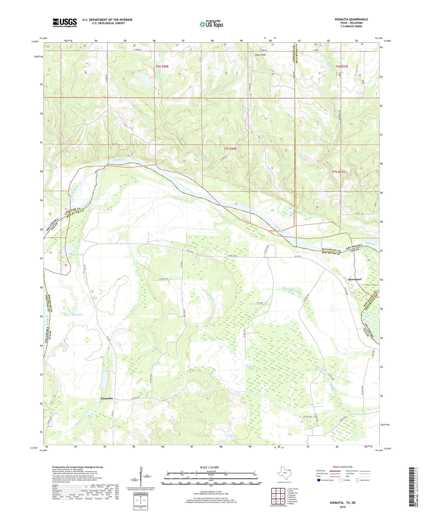
2022 topographic map quadrangle Kiomatia in the states of Texas, Oklahoma. Scale: 1:24000. Based on the newly updated USGS 7.5' US Topo map series, this map is in the following counties: Red River, Choctaw, McCurtain. The map contains contour data, water features, and other items you are used to seeing on USGS maps, but also has updated roads and other features. This is the next generation of topographic maps. Printed on high-quality waterproof paper with UV fade-resistant inks.
Quads adjacent to this one:
West: Frogville
Northwest: Fort Towson
North: Swink
Northeast: Wright City
East: Millerton
Southeast: Negley
South: Manchester
Southwest: Woodland
This map covers the same area as the classic USGS quad with code o33095h2.
Contains the following named places: Bartonville Church, Cedar Creek, Davenport, Davenport School, Davenport School Number 1, Davenport School Number 2, Doaksville Creek, Ford Creek, Gates Creek, Kiamichi River, Kiomatia, Kiomatia Agricultural School, Kiomatia Church, Kiomatia School, Mud Lake, New Hope School, Pilot Knob, Riverside Church, Siloam Church, Watermill Church, Wright Lake