MyTopo
Acworth Texas US Topo Map
Couldn't load pickup availability
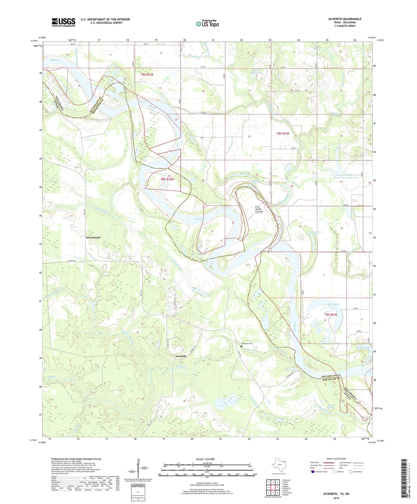
2022 topographic map quadrangle Acworth in the states of Texas, Oklahoma. Scale: 1:24000. Based on the newly updated USGS 7.5' US Topo map series, this map is in the following counties: Red River, McCurtain. The map contains contour data, water features, and other items you are used to seeing on USGS maps, but also has updated roads and other features. This is the next generation of topographic maps. Printed on high-quality waterproof paper with UV fade-resistant inks.
Quads adjacent to this one:
West: Negley
Northwest: Millerton
North: Garvin
Northeast: Idabel
East: Idabel SE
Southeast: English
South: White Rock
Southwest: Dimple
This map covers the same area as the classic USGS quad with code o33094g8.
Contains the following named places: Acworth, Acworth School, Bachman Cemetery, Bad Branch, Bokchito Creek, Bryarly Springs, Chapel Hill School, Colbert Lake, Collier Creek, Ebenezer Church, Greenwood, Greenwood Branch, Greenwood Church, Greenwood School, Horseshoe Lake, Lick-Skillet Cut-Off, Lick-Skillet Lake, Maple Springs School, McKinsey Slough, Mount Olive School, Oknoname 089004 Dam, Oknoname 089004 Reservoir, Perry Creek, Red Lake, Snell Creek, Sulpher Springs Creek, Turkey Branch, Twin Lake, Waterfall-Gilford Creeks Site 1 Dam, Waterfall-Gilford Creeks Site 1 Reservoir, Waterhole Creek, Whitegrass Creek, Williamson Church