MyTopo
Millerton Oklahoma US Topo Map
Couldn't load pickup availability
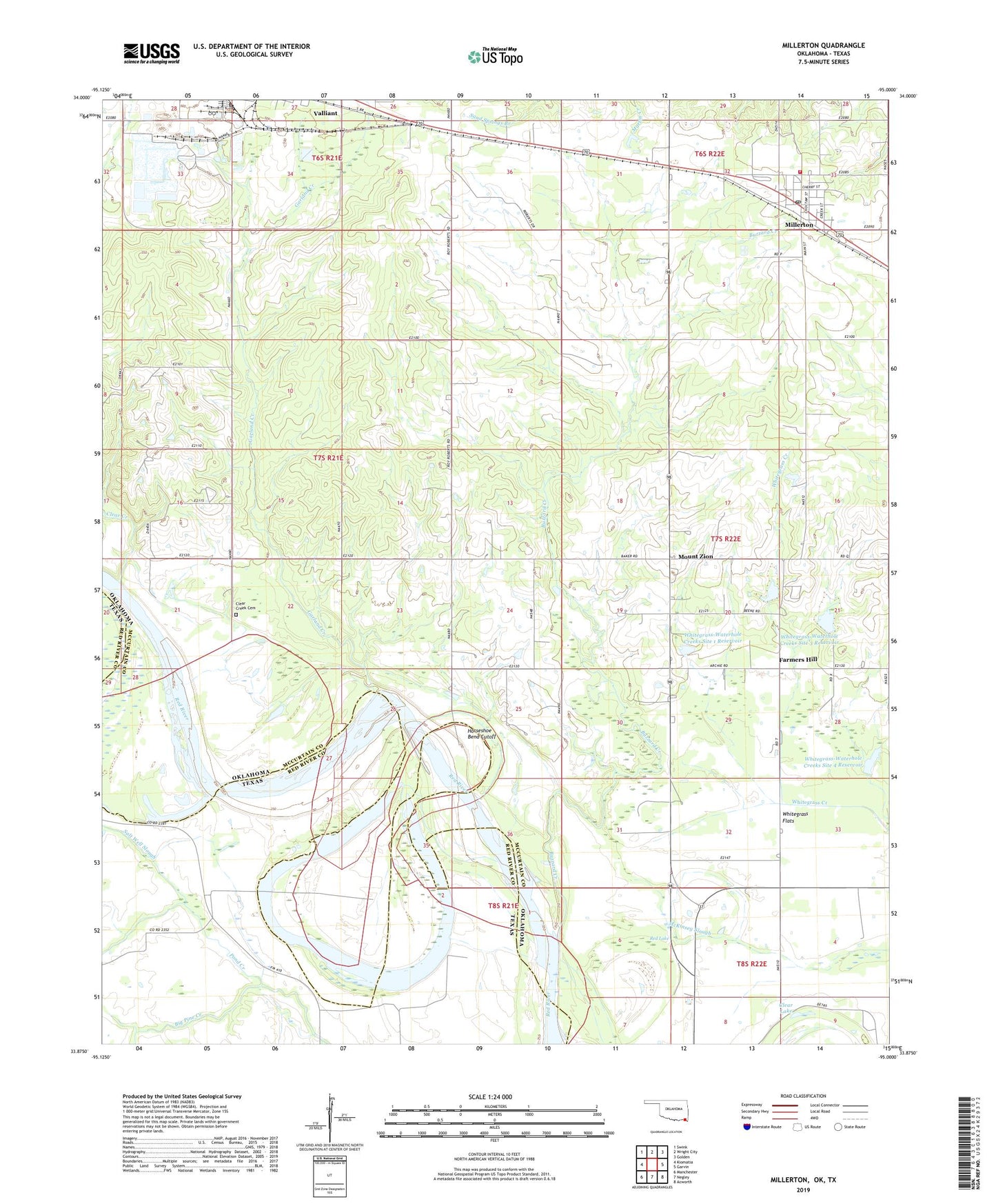
2022 topographic map quadrangle Millerton in the states of Oklahoma, Texas. Scale: 1:24000. Based on the newly updated USGS 7.5' US Topo map series, this map is in the following counties: McCurtain, Red River. The map contains contour data, water features, and other items you are used to seeing on USGS maps, but also has updated roads and other features. This is the next generation of topographic maps. Printed on high-quality waterproof paper with UV fade-resistant inks.
Quads adjacent to this one:
West: Kiomatia
Northwest: Swink
North: Wright City
Northeast: Golden
East: Garvin
Southeast: Acworth
South: Negley
Southwest: Manchester
Contains the following named places: Buzzard Creek, Clear Creek, Clear Creek Cemetery, Clear Creek Church, Clear Lake, Farmers Hill, Forest Hill School, Garland Creek, Horseshoe Bend Cutoff, Millerton, Millerton Fire Department, Millerton Post Office, Mount Zion, Mount Zion School, Olive Branch Baptist Church, Pond Creek, Red Lake, Redland School, Salt Well Slough, State Boundary Reference Monument, Town of Millerton, Whitegrass Ditch, Whitegrass Flats, Whitegrass Waterhole Creeks Site 2 Dam, Whitegrass Waterhole Creeks Site 4 Dam, Whitegrass-Waterhole Creeks Site 1 Dam, Whitegrass-Waterhole Creeks Site 1 Reservoir, Whitegrass-Waterhole Creeks Site 2 Reservoir, Whitegrass-Waterhole Creeks Site 3 Dam, Whitegrass-Waterhole Creeks Site 3 Reservoir, Whitegrass-Waterhole Creeks Site 4 Reservoir, ZIP Code: 74750