MyTopo
Lake Altus Oklahoma US Topo Map
Couldn't load pickup availability
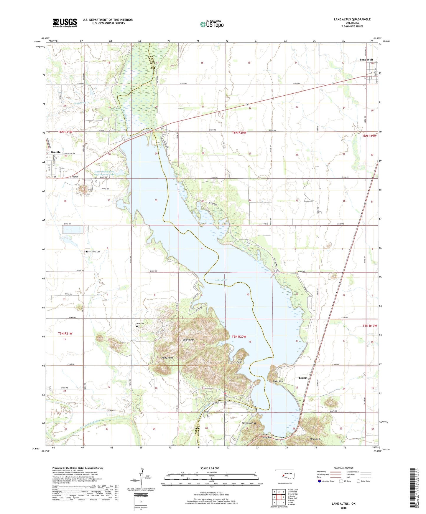
2022 topographic map quadrangle Lake Altus in the state of Oklahoma. Scale: 1:24000. Based on the newly updated USGS 7.5' US Topo map series, this map is in the following counties: Kiowa, Greer. The map contains contour data, water features, and other items you are used to seeing on USGS maps, but also has updated roads and other features. This is the next generation of topographic maps. Printed on high-quality waterproof paper with UV fade-resistant inks.
Quads adjacent to this one:
West: Granite
Northwest: Lake Creek
North: Retrop SE
Northeast: Cambridge
East: Lone Wolf
Southeast: Warren
South: Blair
Southwest: Hester
This map covers the same area as the classic USGS quad with code o34099h3.
Contains the following named places: Altus Dam, Altus-Lugert State Wildlife Management Area, Armstrong Creek, Baldy Point, Granite Cemetery, Hicks Mountain, Lake Altus, Lakeside School, Lugert, Mount Lugert, Oklahoma State Reformatory, Quartz Cemetery, Quartz Mountain, Quartz Mountain State Park, Quartz Mountain Volunteer Fire Association Quartz Mountain State Park, State of Oklahoma Reformatory Dam, State of Oklahoma Reformatory Lake, Town of Granite, Twin Peaks, Williams Peak, ZIP Code: 73655