MyTopo
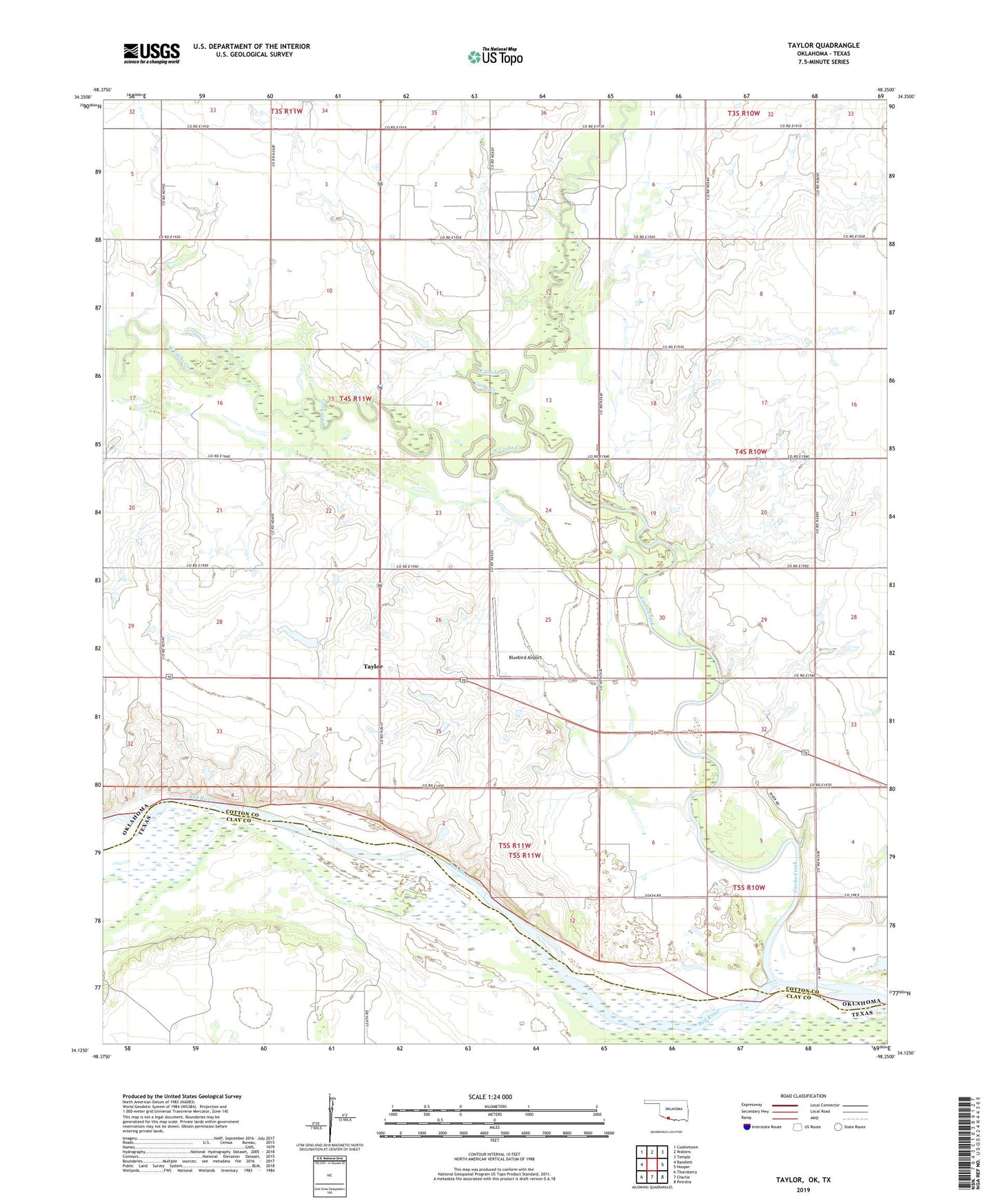
Taylor Oklahoma US Topo Map
Couldn't load pickup availability
2022 topographic map quadrangle Taylor in the state of Oklahoma. Scale: 1:24000. Based on the newly updated USGS 7.5' US Topo map series, this map is in the following counties: Cotton, Clay. The map contains contour data, water features, and other items you are used to seeing on USGS maps, but also has updated roads and other features. This is the next generation of topographic maps. Printed on high-quality waterproof paper with UV fade-resistant inks.
Quads adjacent to this one:
West: Randlett
Northwest: Cookietown
North: Walters
Northeast: Temple
East: Hooper
Southeast: Petrolia
South: Charlie
Southwest: Thornberry
Contains the following named places: Bird Creek, Cache Creek, Cache Creek Oil Field, East Cache Creek, South Cache Creek Oil Field, Stoner Mem Airport, Taylor, Township of Texas, West Cache Creek, West Cache Creek Oil Field