MyTopo
Warner NW Oklahoma US Topo Map
Couldn't load pickup availability
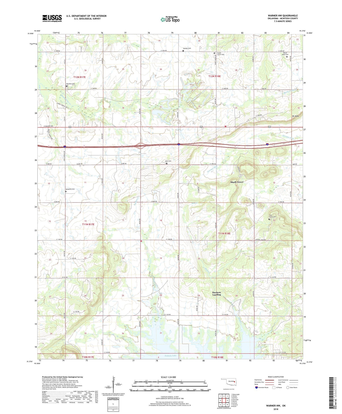
2018 topographic map quadrangle Warner NW in the state of Oklahoma. Scale: 1:24000. Based on the newly updated USGS 7.5' US Topo map series, this map is in the following counties: McIntosh. The map contains contour data, water features, and other items you are used to seeing on USGS maps, but also has updated roads and other features. This is the next generation of topographic maps. Printed on high-quality waterproof paper with UV fade-resistant inks.
Quads adjacent to this one:
West: Checotah
Northwest: Wainwright
North: Oktaha
Northeast: Keefton
East: Warner
Southeast: Porum
South: Texanna
Southwest: Eufaula
Contains the following named places: Central High School, Central High Volunteer Fire Department, Checotah Division, Duchess Creek Wildlife Management Area, Duchess Landing, Duchess Landing Census Designated Place, McIntosh Non-Community, McNaulty Cemetery, Mount Nebo, Mount Nebo Cemetery, Paradise Cemetery, Prairie View School, Shady Grove, Shady Grove Cemetery, Shady Grove Census Designated Place, Shady Grove Central High Volunteer Fire Department, Shady Grove Community, Shady Grove Creek, Twin Grove Cemetery, Vandiver Cemetery, West Cemetery