MyTopo
Buckeye Lake Oregon US Topo Map
Couldn't load pickup availability
Also explore the Buckeye Lake Forest Service Topo of this same quad for updated USFS data
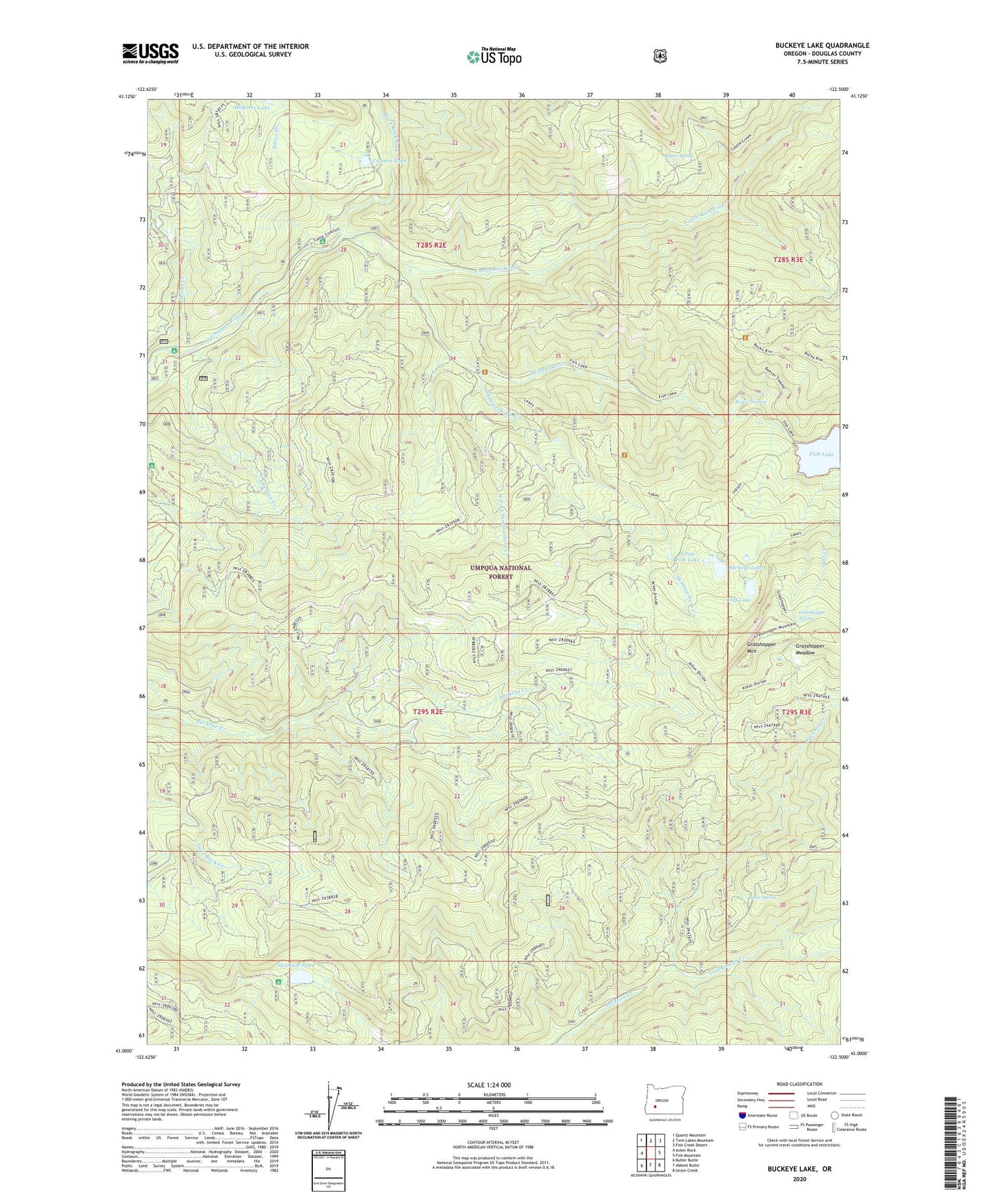
2024 topographic map quadrangle Buckeye Lake in the state of Oregon. Scale: 1:24000. Based on the newly updated USGS 7.5' US Topo map series, this map is in the following counties: Douglas. The map contains contour data, water features, and other items you are used to seeing on USGS maps, but also has updated roads and other features. This is the next generation of topographic maps. Printed on high-quality waterproof paper with UV fade-resistant inks.
Quads adjacent to this one:
West: Acker Rock
Northwest: Quartz Mountain
North: Twin Lakes Mountain
Northeast: Fish Creek Desert
East: Fish Mountain
Southeast: Union Creek
South: Abbott Butte
Southwest: Butler Butte
This map covers the same area as the classic USGS quad with code o43122a5.
Contains the following named places: Acker Divide Trail, Alligator Lake, Beaver Swamp, Beaver Swamp Recreation Site, Beaver Swamp Trailhead, Black Rock Fork, Buckeye Lake, Buckeye Lake Campground, Buster Spring, Buster Spring Shelter, Camp Comfort Recreation Site, Carmen Lake, Castle Rock Fork, Castor Lake, Cliff Lake, Cliff Lake Campground, Emerson Creek, Emerson Ranch, Fish Lake, Fish Lake Creek, Fish Lake Recreation Site, Fish Lake Trailhead, Grasshopper Meadow, Grasshopper Mountain, Grasshopper Spring, Jackson Creek Trail, Jade Camp, Little Fish Lake, Lonewoman Creek, Mink Creek, Mosquito Camp, Sadie Spring, Silver Creek, Skillet Creek, Skimmerhorn Creek, Skimmerhorn Recreation Site, Skimmerhorn Trailhead, Skookum Pond, South Umpqua Falls Recreation Site, West Fork Skimmerhorn Creek