MyTopo
Homedale Idaho US Topo Map
Couldn't load pickup availability
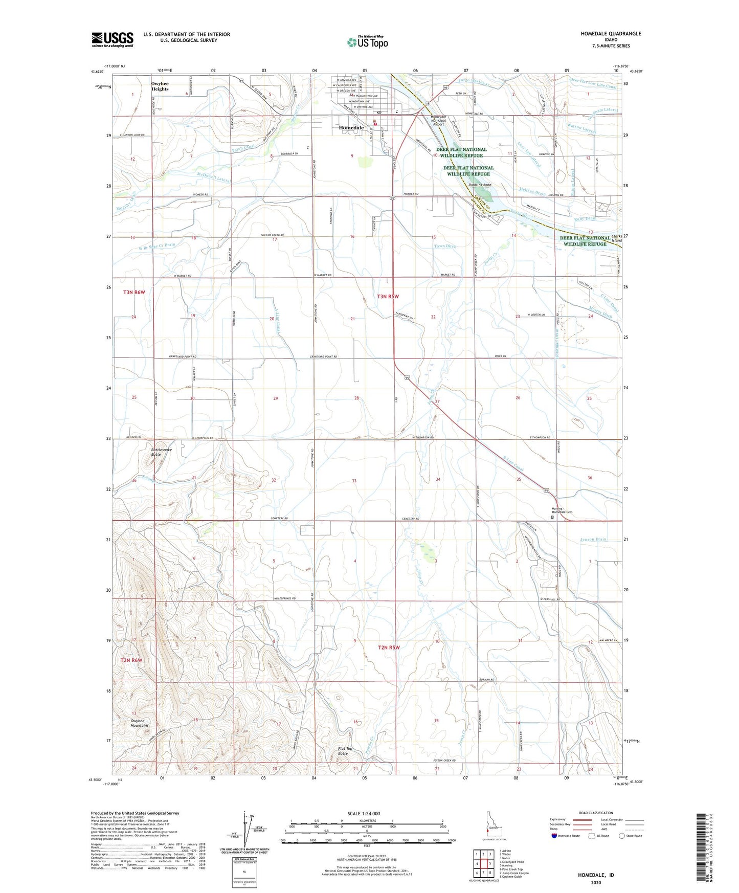
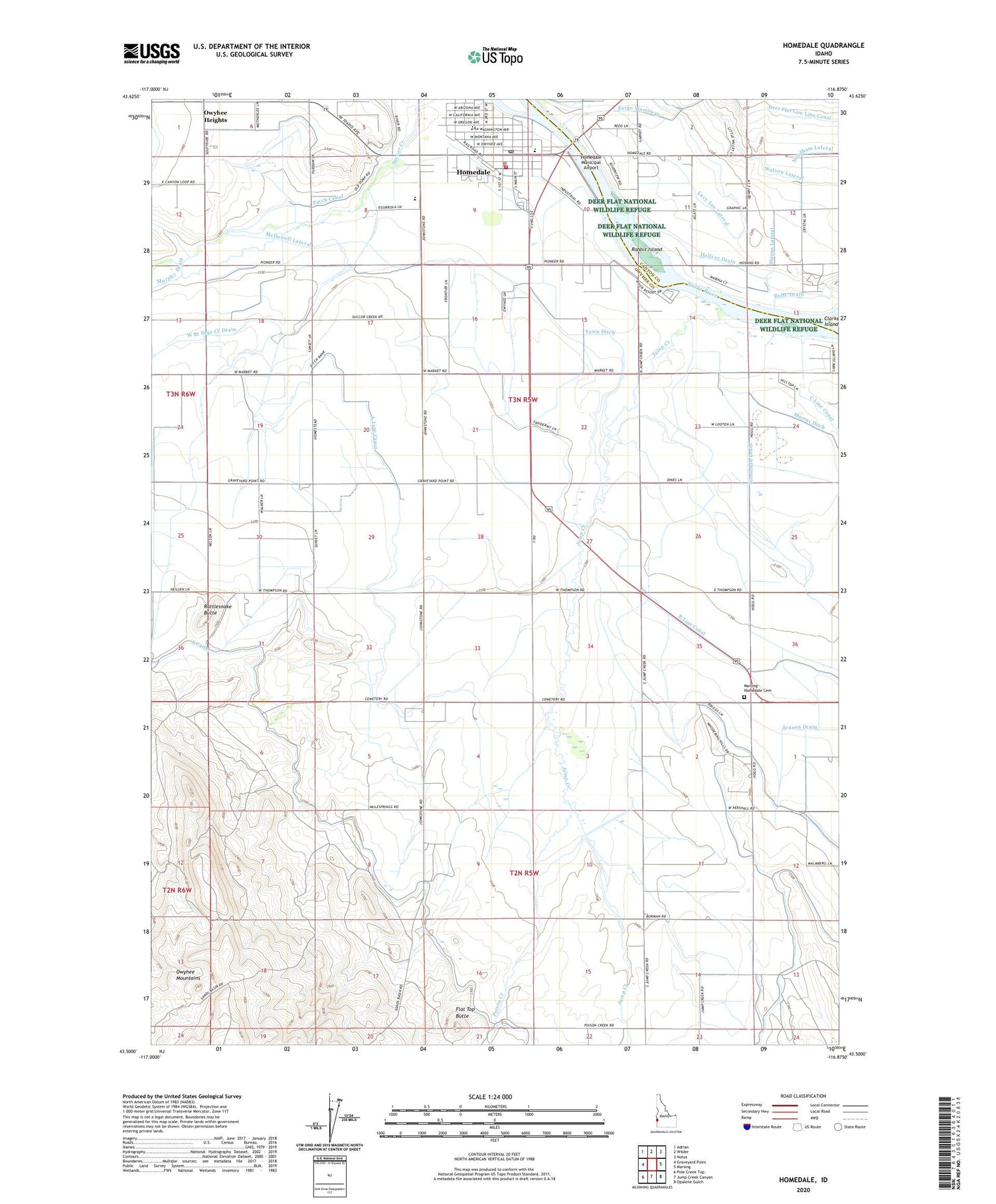
2024 topographic map quadrangle Homedale in the state of Idaho. Scale: 1:24000. Based on the newly updated USGS 7.5' US Topo map series, this map is in the following counties: Owyhee, Canyon. The map contains contour data, water features, and other items you are used to seeing on USGS maps, but also has updated roads and other features. This is the next generation of topographic maps. Printed on high-quality waterproof paper with UV fade-resistant inks.
Quads adjacent to this one:
West: Graveyard Point
Northwest: Adrian
North: Wilder
Northeast: Notus
East: Marsing
Southeast: Opalene Gulch
South: Jump Creek Canyon
Southwest: Pole Creek Top
This map covers the same area as the classic USGS quad with code o43116e8.
Contains the following named places: A Line Canal, B Line Canal, City of Homedale, Fargo Wasteway, Flat Top Butte, Hellyer Drain, Homedale, Homedale Division, Homedale Elementary School, Homedale Fire Department, Homedale High School, Homedale Municipal Airport, Homedale Police Department, Homedale Post Office, Horstman Drain, Jenson Drain, Jump Creek, Lucy Lee Lateral, Marsing - Homedale Cemetery, McDowell Lateral, Murphy Drain, Murray Ditch, Owyhee Heights, Patch Canal, Phipps Lateral, Poison Creek, Poison Creek Stage Station, Rabbit Island, Rattlesnake Butte, Ruby Drain, Sage Creek, South Canal, Town Ditch, Watson Lateral, ZIP Code: 83628