MyTopo
Graveyard Point Idaho US Topo Map
Couldn't load pickup availability
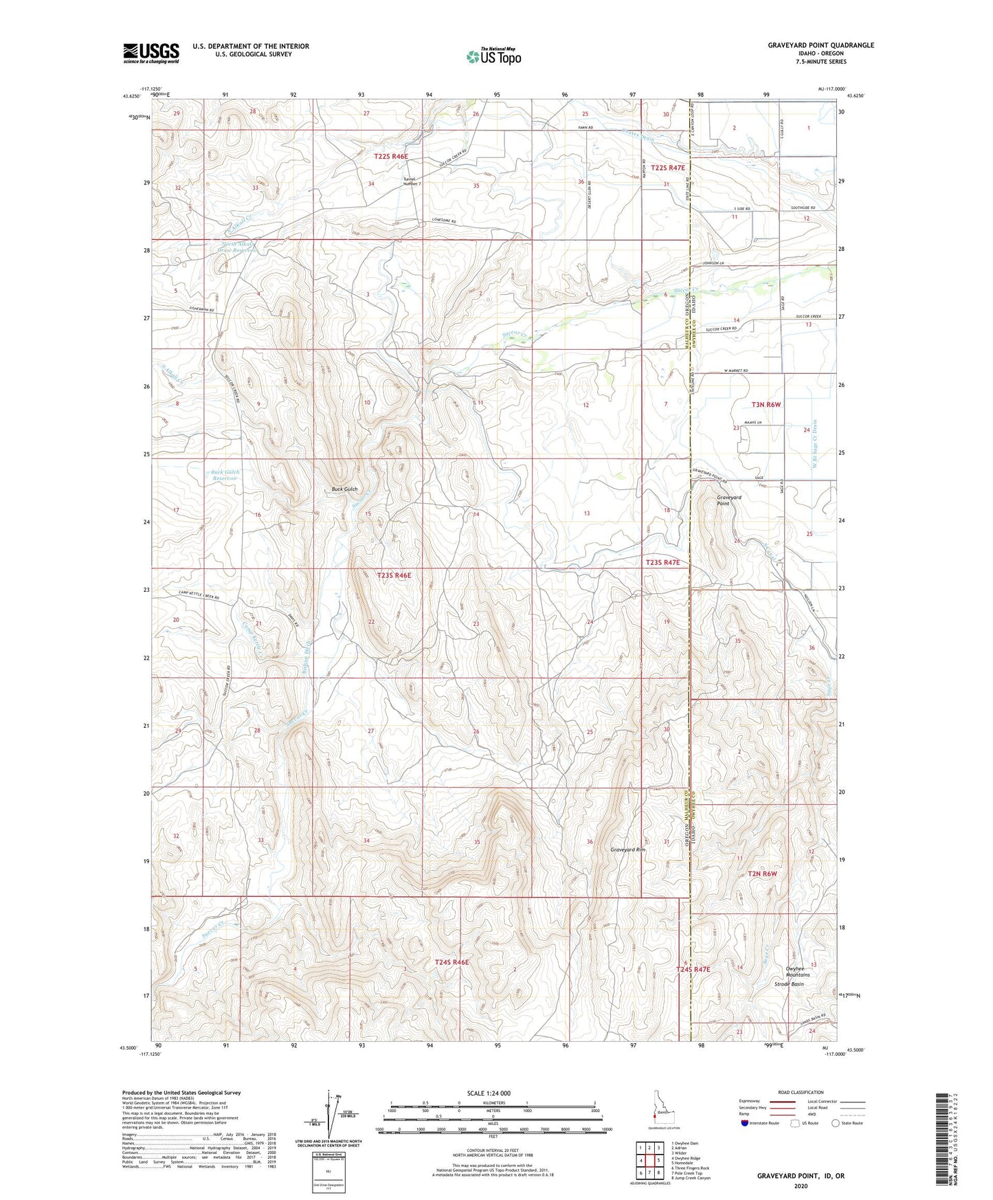
2023 topographic map quadrangle Graveyard Point in the states of Oregon, Idaho. Scale: 1:24000. Based on the newly updated USGS 7.5' US Topo map series, this map is in the following counties: Owyhee, Malheur. The map contains contour data, water features, and other items you are used to seeing on USGS maps, but also has updated roads and other features. This is the next generation of topographic maps. Printed on high-quality waterproof paper with UV fade-resistant inks.
Quads adjacent to this one:
West: Owyhee Ridge
Northwest: Owyhee Dam
North: Adrian
Northeast: Wilder
East: Homedale
Southeast: Jump Creek Canyon
South: Pole Creek Top
Southwest: Three Fingers Rock
Contains the following named places: Agate Field, Ant Hill Reservoir, Bishop Ditch, Bishop Ranch, Buck Gulch, Buck Gulch Reservoir, Camp Kettle Creek, Coates Drain, Davis Ranch, Five and Seventenths Canal, Graveyard Point, Graveyard Rim, North Alkali Creek Siphon, North Alkali Draw Reservoir, Shifting Sands Reservoir, South Alkali Creek, Strode Basin, Succor Creek Siphon, Sucker Post Office, Tunnel Number 7, West Branch Sage Creek Drain, ZIP Code: 97901