MyTopo
Owyhee Ridge Oregon US Topo Map
Couldn't load pickup availability
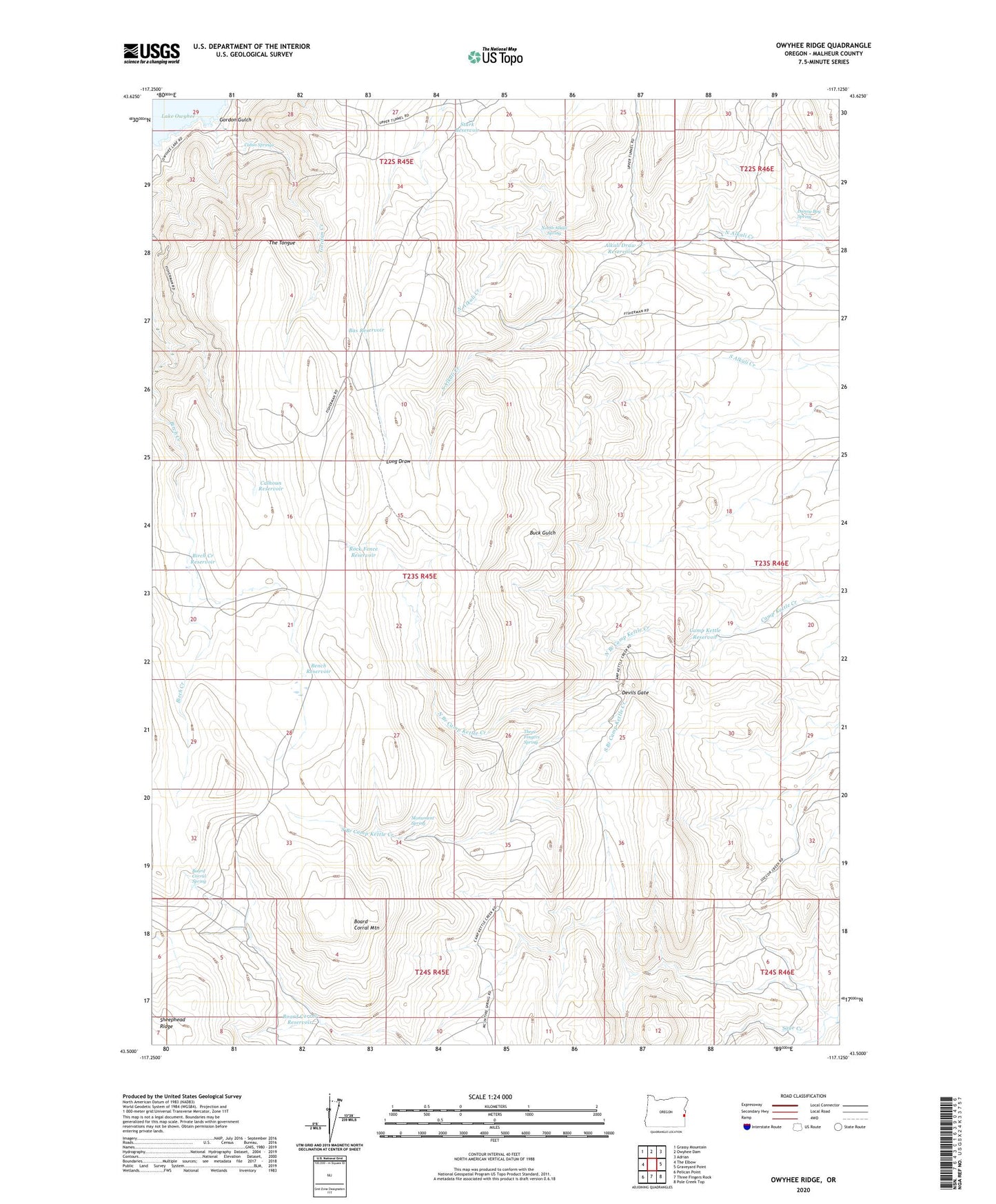
2023 topographic map quadrangle Owyhee Ridge in the state of Oregon. Scale: 1:24000. Based on the newly updated USGS 7.5' US Topo map series, this map is in the following counties: Malheur. The map contains contour data, water features, and other items you are used to seeing on USGS maps, but also has updated roads and other features. This is the next generation of topographic maps. Printed on high-quality waterproof paper with UV fade-resistant inks.
Quads adjacent to this one:
West: The Elbow
Northwest: Grassy Mountain
North: Owyhee Dam
Northeast: Adrian
East: Graveyard Point
Southeast: Pole Creek Top
South: Three Fingers Rock
Southwest: Pelican Point
This map covers the same area as the classic USGS quad with code o43117e2.
Contains the following named places: Alkali Draw Reservoir, Bas Reservoir, Bench Reservoir, Birch Creek Reservoir, Board Corral Mountain, Board Corral Reservoir, Board Corral Spring, Cabin Springs, Calhoun Reservoir, Camp Kettle Reservoir, Danny Boy Spring, Devils Gate, Gordon Creek, Gordon Gulch, Lake Owyhee Gordon Gulch Day Use Boat Ramp, Lake Owyhee State Park, Monument Spring, North Alkali Spring, North Branch Camp Kettle Creek, Rock Fence Reservoir, Sage Creek, South Branch Camp Kettle Creek, Stark Reservoir, Swigert Cow Camp, The Tongue, Three Fingers Spring