MyTopo
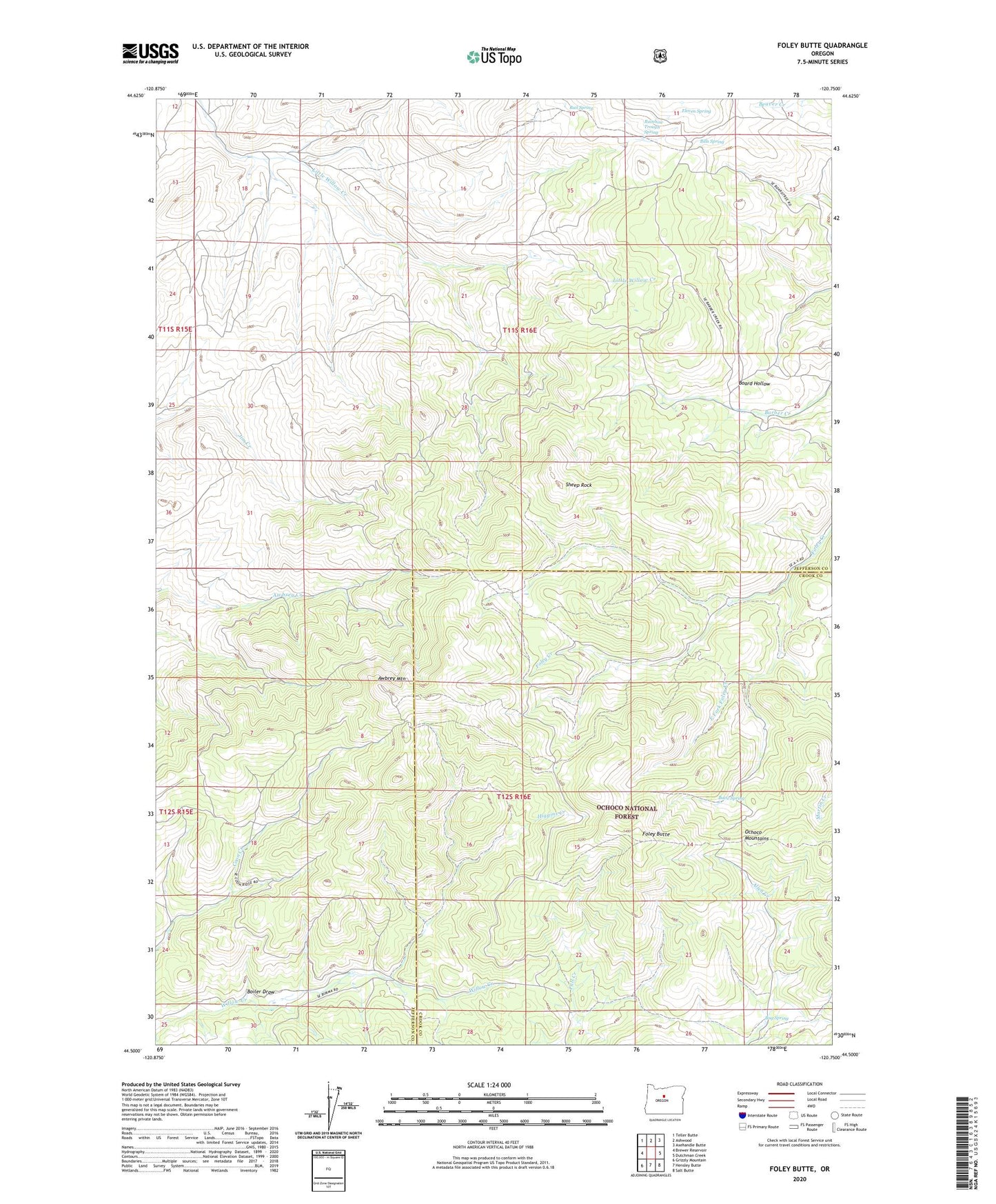
Foley Butte Oregon US Topo Map
Couldn't load pickup availability
Also explore the Foley Butte Forest Service Topo of this same quad for updated USFS data
2023 topographic map quadrangle Foley Butte in the state of Oregon. Scale: 1:24000. Based on the newly updated USGS 7.5' US Topo map series, this map is in the following counties: Jefferson, Crook. The map contains contour data, water features, and other items you are used to seeing on USGS maps, but also has updated roads and other features. This is the next generation of topographic maps. Printed on high-quality waterproof paper with UV fade-resistant inks.
Quads adjacent to this one:
West: Brewer Reservoir
Northwest: Teller Butte
North: Ashwood
Northeast: Axehandle Butte
East: Dutchman Creek
Southeast: Salt Butte
South: Hensley Butte
Southwest: Grizzly Mountain
This map covers the same area as the classic USGS quad with code o44120e7.
Contains the following named places: Awbrey Mountain, Bills Spring, Boiler Draw, Bug Spring, Butte Spring, East Fork Foley Creek, Eleven Spring, Foley Butte, Foley Butte Lookout Tower, Higgins Creek, Rail Spring, Rainbow Trough Spring, Sheep Rock