
MyTopo
Belshaw Meadows Oregon US Topo Map
Couldn't load pickup availability
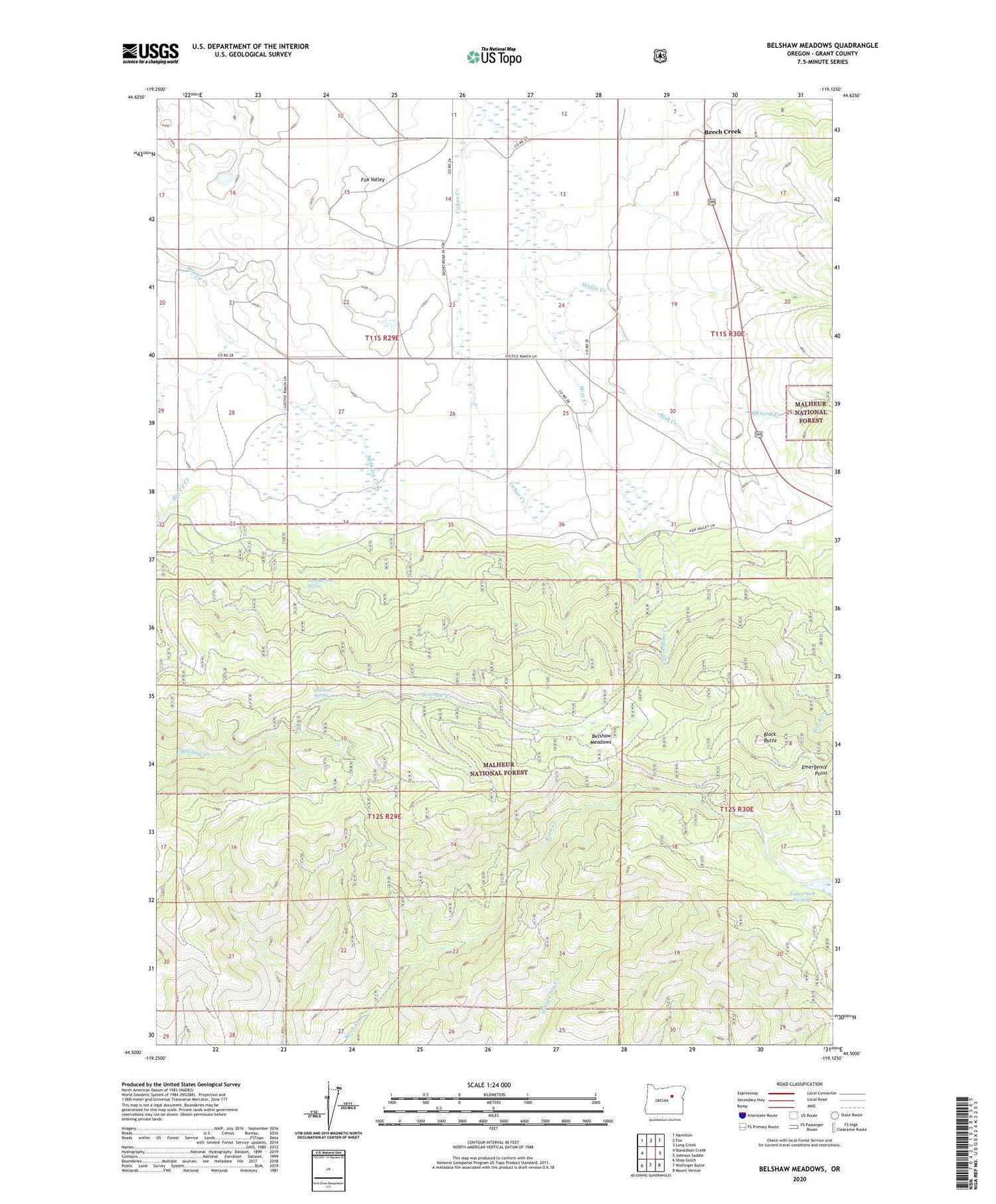
2020 topographic map quadrangle Belshaw Meadows in the state of Oregon. Scale: 1:24000. Based on the newly updated USGS 7.5' US Topo map series, this map is in the following counties: Grant. The map contains contour data, water features, and other items you are used to seeing on USGS maps, but also has updated roads and other features. This is the next generation of topographic maps. Printed on high-quality waterproof paper with UV fade-resistant inks.
Quads adjacent to this one:
West: Donaldson Creek
Northwest: Hamilton
North: Fox
Northeast: Long Creek
East: Johnson Saddle
Southeast: Mount Vernon
South: Wolfinger Butte
Southwest: Shop Gulch
Contains the following named places: Beech Creek, Beech Creek Post Office, Belsham Spring, Belshaw Meadows, Big Nugget Mine, Black Butte, Black Butte Mine, Cohoe Creek, Cohoe Mine, East Creek, East Fork Mine Creek, Emergency Point, Fish Creek, Fox Mine, Fox Valley, McHaley Creek, Mine Creek, Mine Creek Placer Mine, Number One Spring, Stewart Creek, Tamarack Swamp


