MyTopo
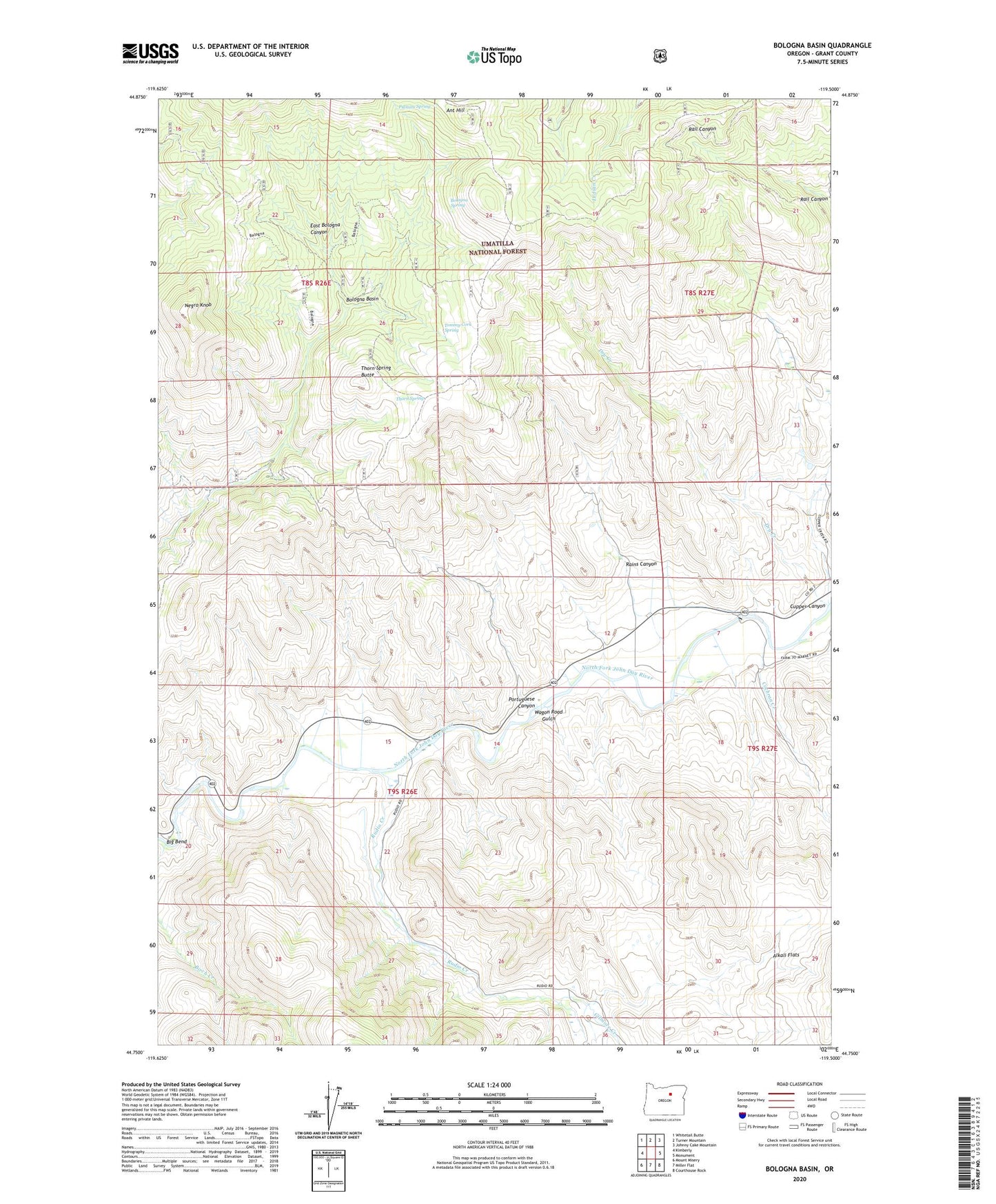
Bologna Basin Oregon US Topo Map
Couldn't load pickup availability
Also explore the Bologna Basin Forest Service Topo of this same quad for updated USFS data
2023 topographic map quadrangle Bologna Basin in the state of Oregon. Scale: 1:24000. Based on the newly updated USGS 7.5' US Topo map series, this map is in the following counties: Grant. The map contains contour data, water features, and other items you are used to seeing on USGS maps, but also has updated roads and other features. This is the next generation of topographic maps. Printed on high-quality waterproof paper with UV fade-resistant inks.
Quads adjacent to this one:
West: Kimberly
Northwest: Whitetail Butte
North: Turner Mountain
Northeast: Johnny Cake Mountain
East: Monument
Southeast: Courthouse Rock
South: Miller Flat
Southwest: Mount Misery
This map covers the same area as the classic USGS quad with code o44119g5.
Contains the following named places: Alkali Flats, Ant Hill, Big Bend, Birch Creek, Bologna Basin, Bologna Spring, Cochran Creek, Cupper Canyon, Dry Creek, Gilmore Creek, Neal Dam, Negro Knob, Negro Knob Trail, Portuguese Canyon, Putnam Spring, Rains Canyon, Rudio Creek, Thorn Spring, Thorn Spring Butte, Tommy Cork Spring, Wagon Road Gulch, Waller Reservoir Number Four, West Fork Cochran Creek