MyTopo
Kimberly Oregon US Topo Map
Couldn't load pickup availability
Also explore the Kimberly Forest Service Topo of this same quad for updated USFS data
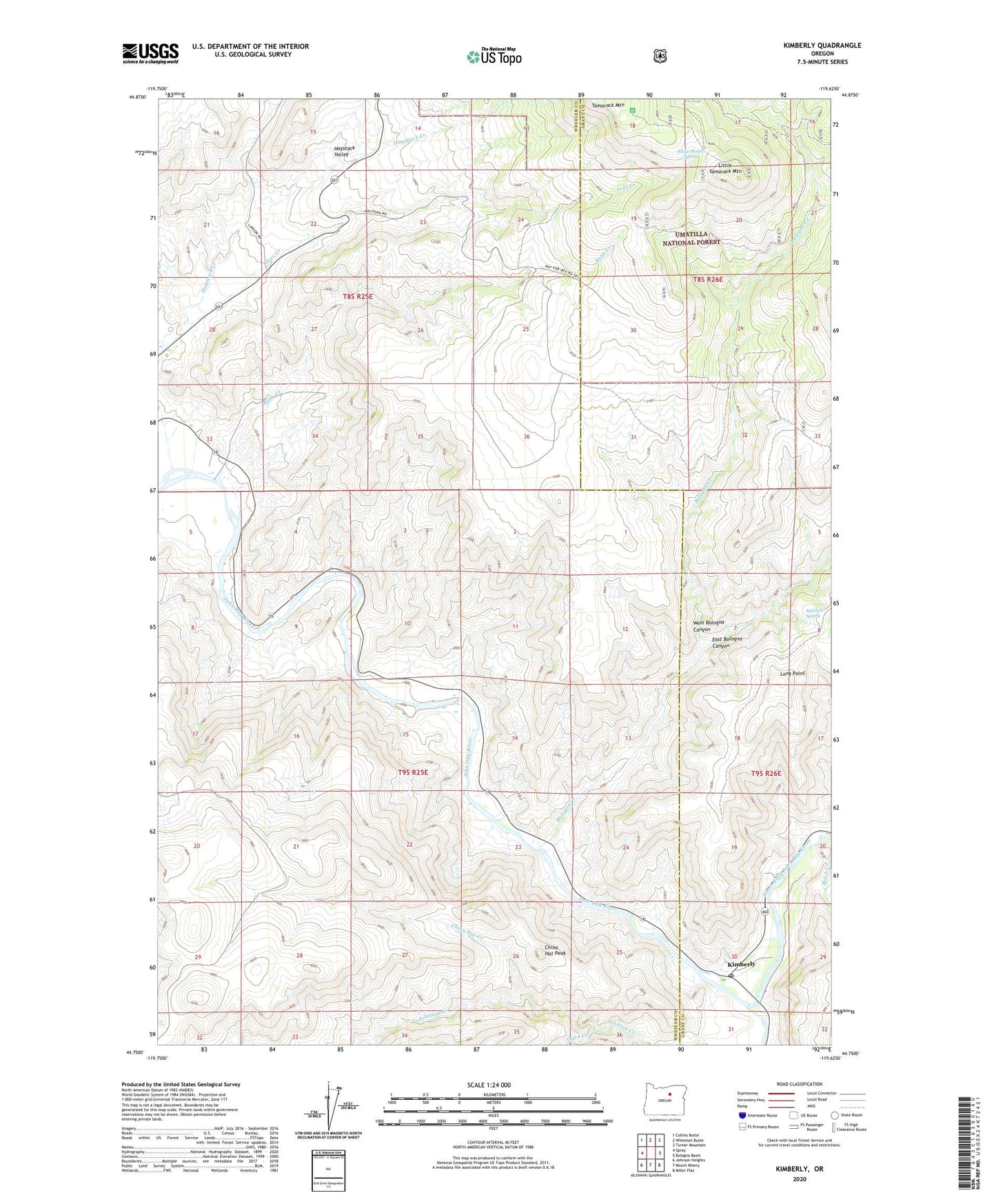
2023 topographic map quadrangle Kimberly in the state of Oregon. Scale: 1:24000. Based on the newly updated USGS 7.5' US Topo map series, this map is in the following counties: Wheeler, Grant. The map contains contour data, water features, and other items you are used to seeing on USGS maps, but also has updated roads and other features. This is the next generation of topographic maps. Printed on high-quality waterproof paper with UV fade-resistant inks.
Quads adjacent to this one:
West: Spray
Northwest: Collins Butte
North: Whitetail Butte
Northeast: Turner Mountain
East: Bologna Basin
Southeast: Miller Flat
South: Mount Misery
Southwest: Johnson Heights
This map covers the same area as the classic USGS quad with code o44119g6.
Contains the following named places: Balm Creek, Bologna Creek, China Hat Creek, China Hat Peak, East Bologna Canyon, Ives Creek, Kimberly, Kimberly Post Office, Knob Trail, Little Tamarack Mountain, Long Point, Mitchell Spring, North Fork John Day River, Potter Ditch, Second Creek, Spring Valley Post Office, Tamarack Lookout Tower, Tamarack Mountain, Third Creek, West Bologna Canyon, White House Spring