
MyTopo
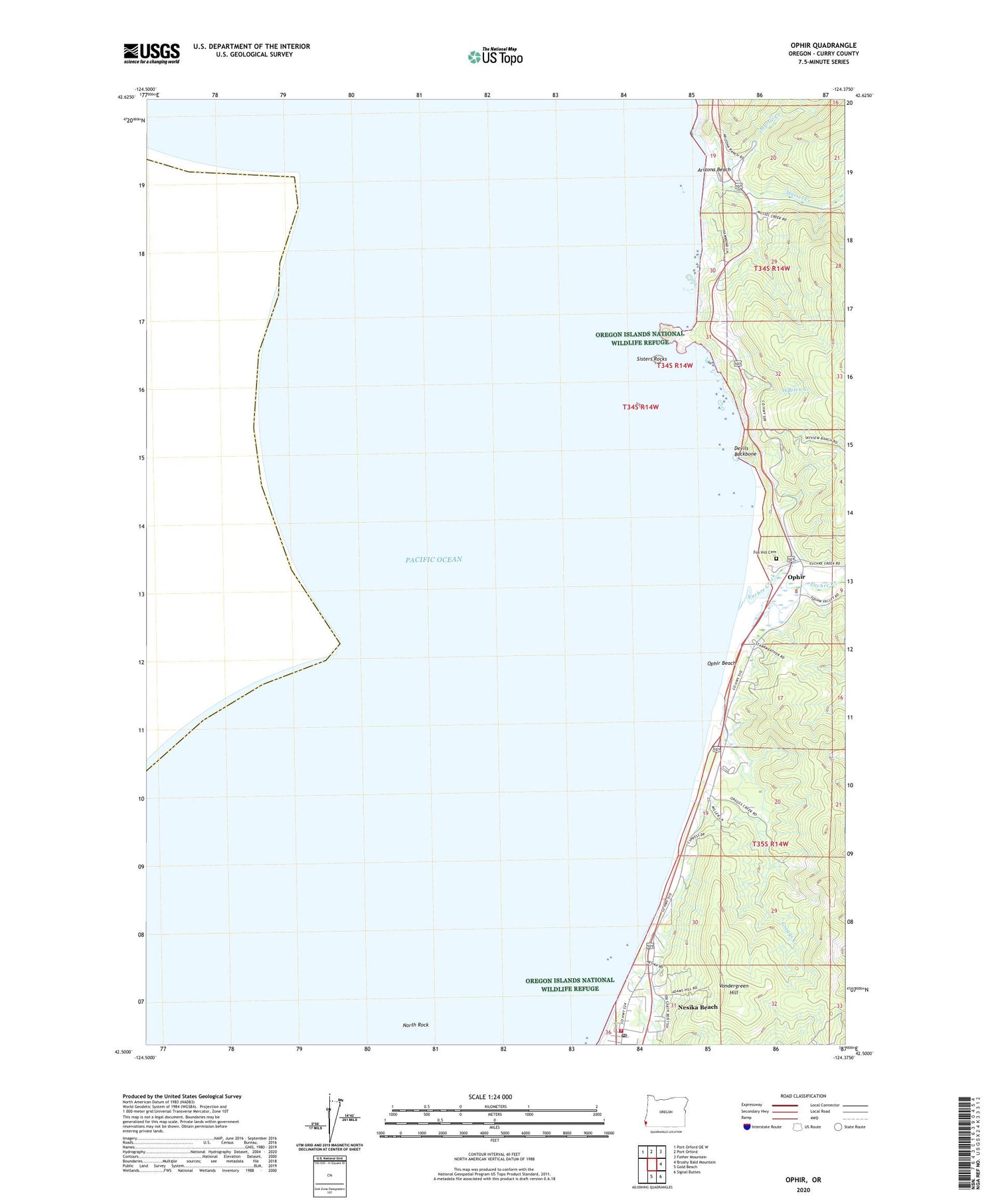
Ophir Oregon US Topo Map
Couldn't load pickup availability
Also explore the Ophir Forest Service Topo of this same quad for updated USFS data
2024 topographic map quadrangle Ophir in the state of Oregon. Scale: 1:24000. Based on the newly updated USGS 7.5' US Topo map series, this map is in the following counties: Curry. The map contains contour data, water features, and other items you are used to seeing on USGS maps, but also has updated roads and other features. This is the next generation of topographic maps. Printed on high-quality waterproof paper with UV fade-resistant inks.
Quads adjacent to this one:
Northwest: Port Orford OE W
North: Port Orford
Northeast: Father Mountain
East: Brushy Bald Mountain
Southeast: Signal Buttes
South: Gold Beach
This map covers the same area as the classic USGS quad with code o42124e4.
Contains the following named places: Arizona Beach, Corbin, Corbin Post Office, Devils Backbone, Euchre Creek, Fox Hill Cemetery, Frankport, Greggs Creek, Mussel Creek, Myrtle Creek, Nesika Beach, Nesika Beach Census Designated Place, North Rock, O'Brien Creek, Ophir, Ophir Beach, Ophir Post Office, Ophir Rural Fire Department, Ophir Safety Rest Area, Parker Creek, Sisters Rock State Park, Sisters Rocks, Vondergreen Hill


