
MyTopo
China Flat Oregon US Topo Map
Couldn't load pickup availability
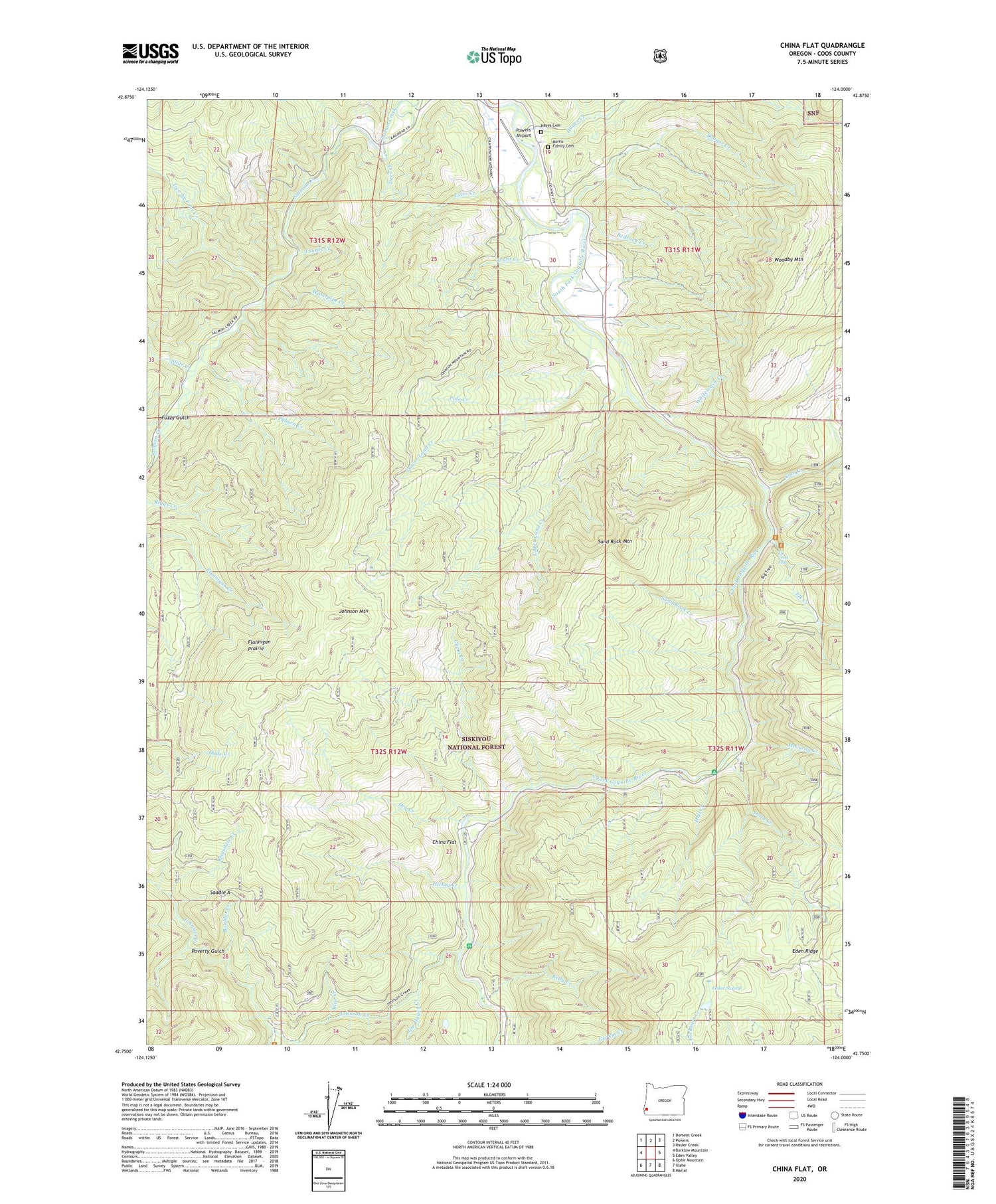
2020 topographic map quadrangle China Flat in the state of Oregon. Scale: 1:24000. Based on the newly updated USGS 7.5' US Topo map series, this map is in the following counties: Coos. The map contains contour data, water features, and other items you are used to seeing on USGS maps, but also has updated roads and other features. This is the next generation of topographic maps. Printed on high-quality waterproof paper with UV fade-resistant inks.
Quads adjacent to this one:
West: Barklow Mountain
Northwest: Dement Creek
North: Powers
Northeast: Rasler Creek
East: Eden Valley
Southeast: Marial
South: Illahe
Southwest: Ophir Mountain
Contains the following named places: Bedrock Creek, Big Tree Campground, Blue Creek, Bonner Creek, Boulder Creek, Boundary Campground, Boundary Picnic Ground, Cedar Swamp, China Creek, China Flat, China Flat Campground, Coal Creek, Coal Creek Campground, Deer Creek, Delta Creek, Dry Creek, Elk Creek, Elk Creek Falls, Elk Creek Falls Recreation Site, Estes Creek, Flannigan Prairie, Fuzzy Gulch, Grant Creek, Gurkin Creek, Hall Creek, Hayes Cemetery, Hayes Creek, Hickey Creek, Jim Hayes Creek, Johnson Creek, Johnson Mountain, Kelly Creek, Laird Creek, Lower Land Creek, McCurdy Creek, Myrtle Grove Recreation Site, Norris Family Cemetery, North Fork Elk Creek, Orchard Park Boat Launch, Pole Creek, Poverty Gulch, Powers Airport, Powers City Park, Powers Division, Pyburn Creek, Ragsdale Creek, Rural Post Office, Saddle A, Sand Rock Creek, Sand Rock Mountain, Slide Creek, South Fork Elk Creek, Sucker Creek, Tunnel Creek, Two by Four Creek, Upper Land Creek, Waterpipe Creek, Whitewash Creek, Woodby Mountain, ZIP Code: 97466


