MyTopo
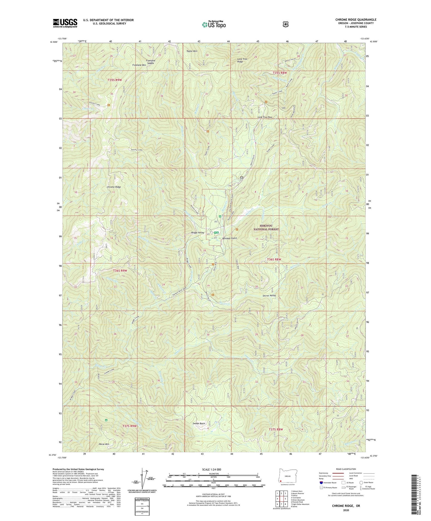
Chrome Ridge Oregon US Topo Map
Couldn't load pickup availability
Also explore the Chrome Ridge Forest Service Topo of this same quad for updated USFS data
2023 topographic map quadrangle Chrome Ridge in the state of Oregon. Scale: 1:24000. Based on the newly updated USGS 7.5' US Topo map series, this map is in the following counties: Josephine. The map contains contour data, water features, and other items you are used to seeing on USGS maps, but also has updated roads and other features. This is the next generation of topographic maps. Printed on high-quality waterproof paper with UV fade-resistant inks.
Quads adjacent to this one:
West: York Butte
Northwest: Hobson Horn
North: Mount Peavine
Northeast: Galice
East: Onion Mountain
Southeast: Selma
South: Eight Dollar Mountain
Southwest: Pearsoll Peak
This map covers the same area as the classic USGS quad with code o42123d6.
Contains the following named places: Barr Mine, Big Pine Recreation Site, Briggs Valley, Brushy Creek, Chrome Camp, Chrome Ridge, Courier Mine, Dutchy Creek, Elkhorn Creek, Elkhorn Mine, Freeland Mountain, Freeland Saddle, Granite Creek, Horse Creek, Horse Mountain, Lone Tree Creek, Lone Tree Pass, Lone Tree Ridge, Maple Creek, Minnow Creek, Myers Creek, Myers Creek Recreation Site, Onion Creek, Sam Brown Horse Camp, Sam Brown Recreation Site, Secret Creek, Secret Creek Recreation Site, Secret Valley, South Fork Taylor Creek, Swede Basin, Swede Creek, Taylor Mountain, Valley Creek, Waterdog Creek, Whiskey Gulch, Wilderville Division, Windy Creek