MyTopo
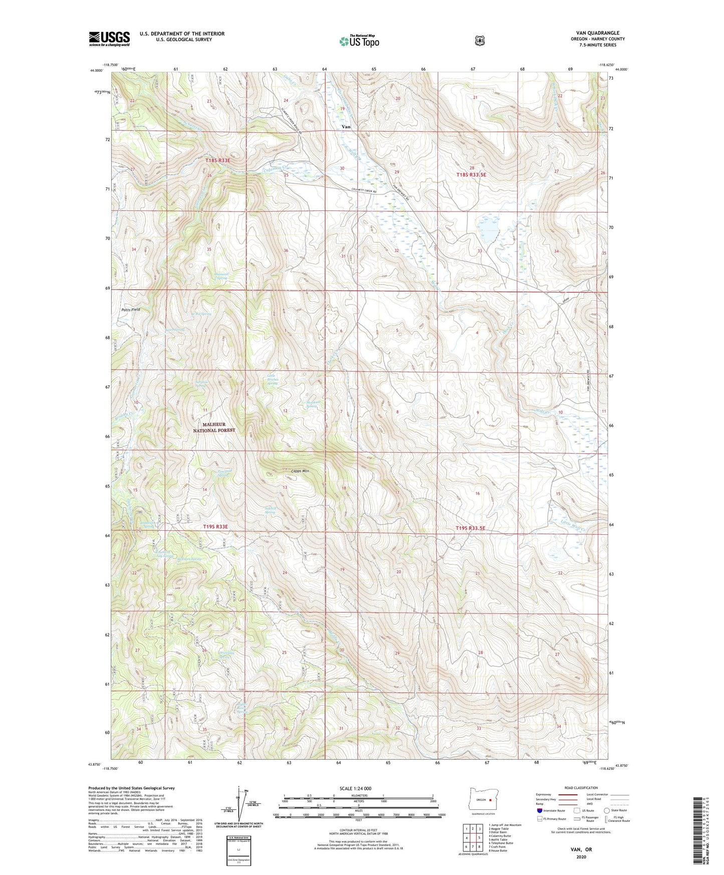
Van Oregon US Topo Map
Couldn't load pickup availability
Also explore the Van Forest Service Topo of this same quad for updated USFS data
2023 topographic map quadrangle Van in the state of Oregon. Scale: 1:24000. Based on the newly updated USGS 7.5' US Topo map series, this map is in the following counties: Harney. The map contains contour data, water features, and other items you are used to seeing on USGS maps, but also has updated roads and other features. This is the next generation of topographic maps. Printed on high-quality waterproof paper with UV fade-resistant inks.
Quads adjacent to this one:
West: Calamity Butte
Northwest: Jump-off Joe Mountain
North: Magpie Table
Northeast: Dollar Basin
East: Moffit Table
Southeast: House Butte
South: Craft Point
Southwest: Telephone Butte
This map covers the same area as the classic USGS quad with code o43118h6.
Contains the following named places: Basco Spring, Brophy Creek, Calamity Creek, Capps Mountain, Cawlfield Ranch, Clarks Creek, Cleveland Ditch, Cleveland Ranch, Diamond J Spring, Driveway Spring, Duck Creek, Duck Creek Reservoir, Fourth of July Spring, Gabe Creek, Gunbarrel Creek, Jack Bear Cabin, Jones Dam, Jones Ranch, Little Briches Spring, McEwen Spring, Muller Basin Spring, Pine Tree Spring, Roadside Spring, Schurtz Creek, Sidehill Spring, Skookum Spring, Surprise Spring, Van, Van Guard Station, Van Post Office, W B J Spring, West Fork Duck Creek