MyTopo
Star Creek Reservoir Oregon US Topo Map
Couldn't load pickup availability
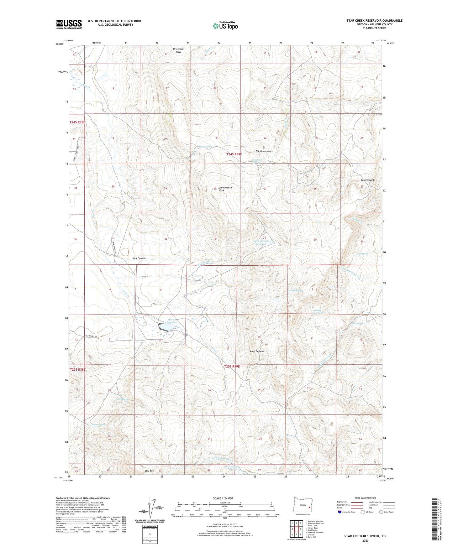
2023 topographic map quadrangle Star Creek Reservoir in the state of Oregon. Scale: 1:24000. Based on the newly updated USGS 7.5' US Topo map series, this map is in the following counties: Malheur. The map contains contour data, water features, and other items you are used to seeing on USGS maps, but also has updated roads and other features. This is the next generation of topographic maps. Printed on high-quality waterproof paper with UV fade-resistant inks.
Quads adjacent to this one:
West: Hickey Basin
Northwest: Mosquito Mountain
North: Shumway Reservoir
Northeast: Alder Creek
East: Skull Spring
Southeast: Burnt Flat
South: Crowley
Southwest: Stockade Mountain
This map covers the same area as the classic USGS quad with code o43117d8.
Contains the following named places: Aspen Spring, Cold Spring, Cold Springs Ranch, Dry Creek Pass, Little Crowley Springs, Monument Springs, Monumental Rock, Rock Spring, Rodger Ranch, Rogers Place, Roostercomb, Sack Canyon, Sack Canyon Reservoir, Star Creek Dam, Star Creek Ditch, Star Creek Reservoir, Star Mountain, Star Ranch, Stump Spring, Sutherland Cabin, The Monuments, Whiskey Jack Spring, Willow Spring, Wood Spring