MyTopo
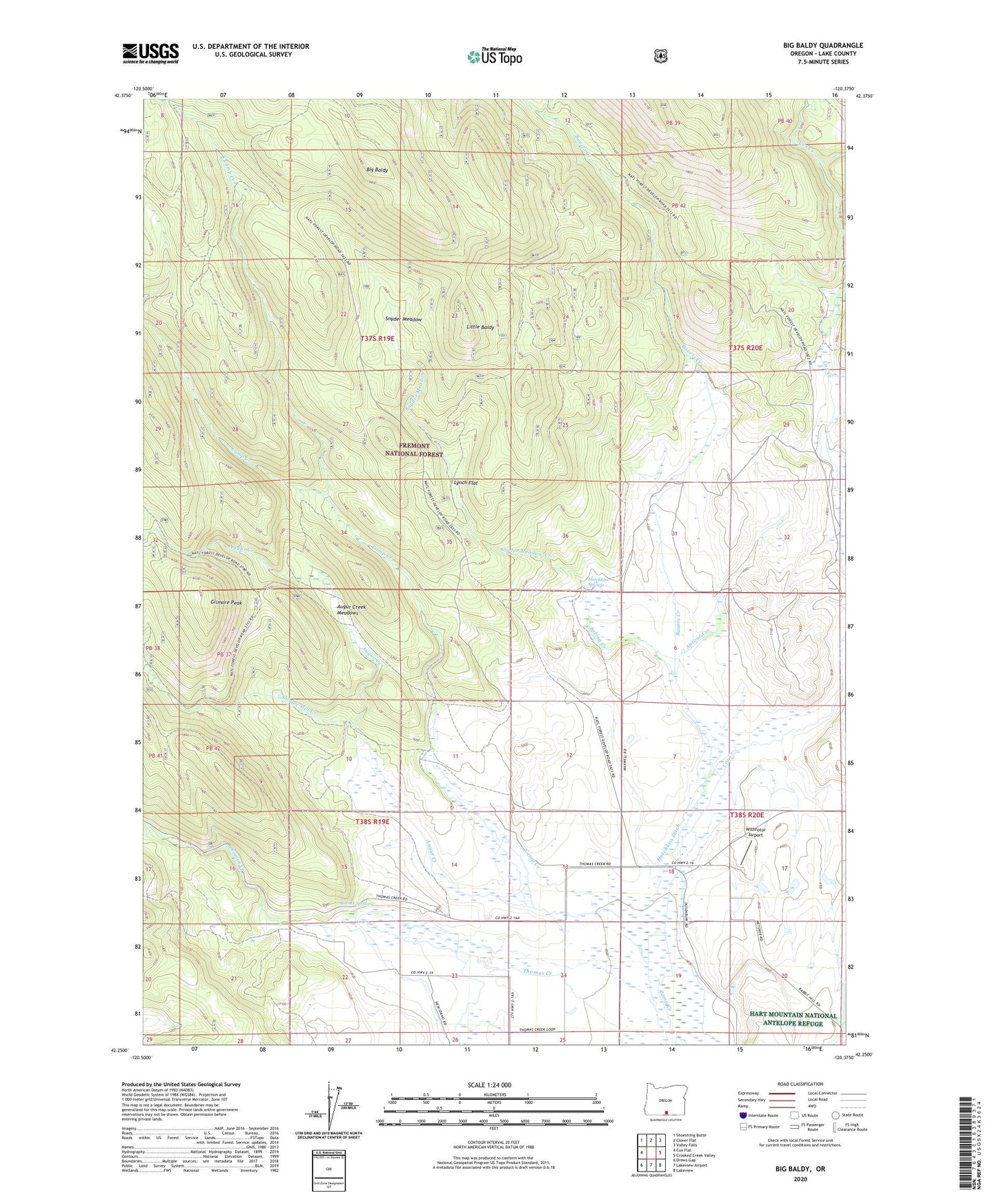
Big Baldy Oregon US Topo Map
Couldn't load pickup availability
Also explore the Big Baldy Forest Service Topo of this same quad for updated USFS data
2023 topographic map quadrangle Big Baldy in the state of Oregon. Scale: 1:24000. Based on the newly updated USGS 7.5' US Topo map series, this map is in the following counties: Lake. The map contains contour data, water features, and other items you are used to seeing on USGS maps, but also has updated roads and other features. This is the next generation of topographic maps. Printed on high-quality waterproof paper with UV fade-resistant inks.
Quads adjacent to this one:
West: Cox Flat
Northwest: Shoestring Butte
North: Clover Flat
Northeast: Valley Falls
East: Crooked Creek Valley
Southeast: Lakeview
South: Lakeview Airport
Southwest: Drews Gap
This map covers the same area as the classic USGS quad with code o42120c4.
Contains the following named places: Antone Creek, Augur Creek, Augur Creek Meadows, Barnes Spring, Bauers Creek, Big Baldy, Cox Creek, East Camp Creek, Fawn Creek, Gilmore Peak, Hammersly Ranch, Hotchkiss Ditch, Hotchkiss Ranch, Hotchkiss Springs, Little Baldy, Lynch Flat, Maxwell Ranch, McDonald Camp, Mendell Ranch, Salt Creek, Shingle Mill Creek, Snyder Meadow, Snyder Meadow Creek, Spring Creek, Withrotor Airport