MyTopo
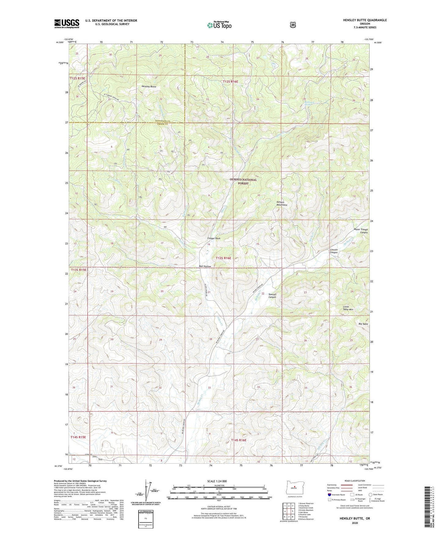
Hensley Butte Oregon US Topo Map
Couldn't load pickup availability
Also explore the Hensley Butte Forest Service Topo of this same quad for updated USFS data
2024 topographic map quadrangle Hensley Butte in the state of Oregon. Scale: 1:24000. Based on the newly updated USGS 7.5' US Topo map series, this map is in the following counties: Crook, Jefferson. The map contains contour data, water features, and other items you are used to seeing on USGS maps, but also has updated roads and other features. This is the next generation of topographic maps. Printed on high-quality waterproof paper with UV fade-resistant inks.
Quads adjacent to this one:
West: Grizzly Mountain
Northwest: Brewer Reservoir
North: Foley Butte
Northeast: Dutchman Creek
East: Salt Butte
Southeast: Ochoco Reservoir
South: Prineville
Southwest: Houston Lake
This map covers the same area as the classic USGS quad with code o44120d7.
Contains the following named places: Allen Creek, Bogue Creek, Bottleneck Spring, Cougar Rock, Elliot Ranch, Fall Creek, Hensley Butte, Kuiman Creek, Lincoln Canyon, Little Table Mountain, Lofton Creek, Rail Hollow, Sawtell Canyon, Sealy Creek, Turner Creek, Upper McKay School, Water Trough Canyon