MyTopo
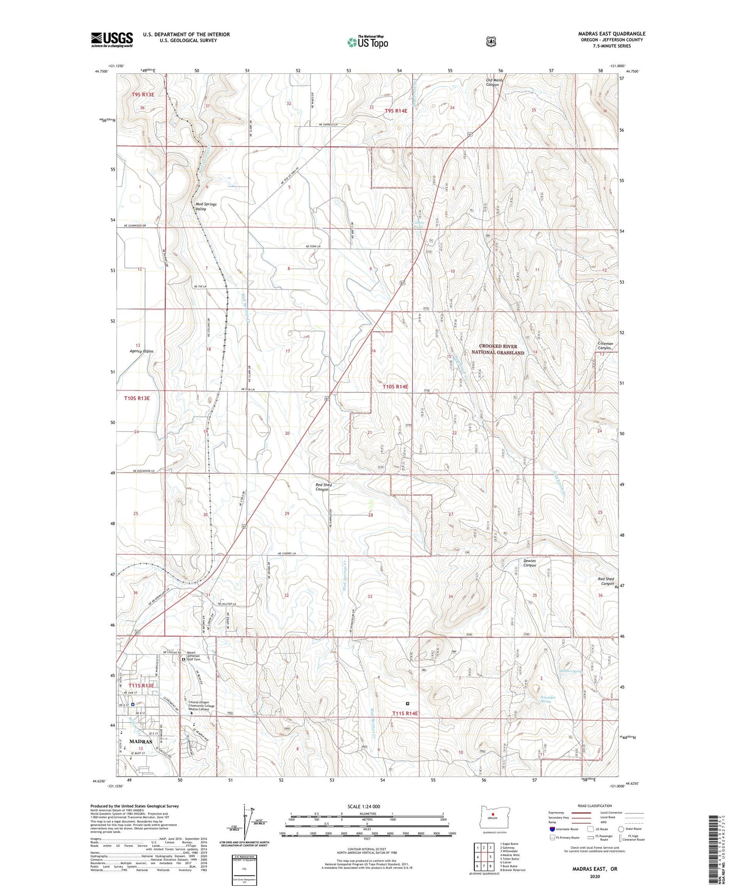
Madras East Oregon US Topo Map
Couldn't load pickup availability
Also explore the Madras East Forest Service Topo of this same quad for updated USFS data
2023 topographic map quadrangle Madras East in the state of Oregon. Scale: 1:24000. Based on the newly updated USGS 7.5' US Topo map series, this map is in the following counties: Jefferson. The map contains contour data, water features, and other items you are used to seeing on USGS maps, but also has updated roads and other features. This is the next generation of topographic maps. Printed on high-quality waterproof paper with UV fade-resistant inks.
Quads adjacent to this one:
West: Madras West
Northwest: Eagle Butte
North: Gateway
Northeast: Willowdale
East: Teller Butte
Southeast: Brewer Reservoir
South: Buck Butte
Southwest: Culver
This map covers the same area as the classic USGS quad with code o44121f1.
Contains the following named places: Bean Park, Buff Elementary School, Coburn Well, Coleman Canyon, Cotter Pond, Cowden Park, Deer Ridge Correctional Institution, Dewies Canyon, Fox Corral, Jefferson County Middle School, Jefferson County Public Works, Juniper Hill Park, Kutcher Well, Madras Elementary School, Madras High School, Monner Spring, Mount Jefferson IOOF Cemetery, Mountain View Hospital, Mountain View Hospital Heliport, Mud Springs Valley, Oak Street Park, Paxton, Red Shed Canyon, Schmoker Spring, Schmoker Well, ZIP Code: 97741