MyTopo
Fuzztail Butte Oregon US Topo Map
Couldn't load pickup availability
Also explore the Fuzztail Butte Forest Service Topo of this same quad for updated USFS data
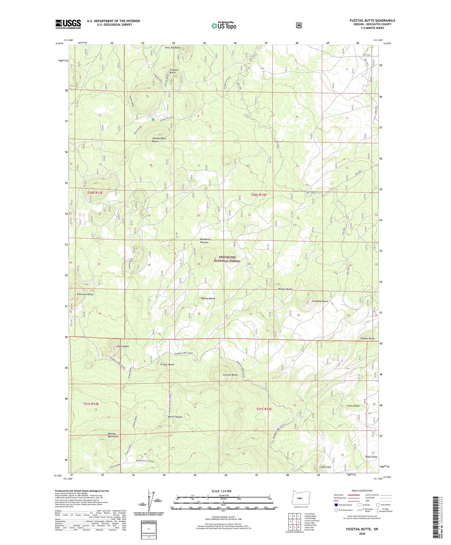
2024 topographic map quadrangle Fuzztail Butte in the state of Oregon. Scale: 1:24000. Based on the newly updated USGS 7.5' US Topo map series, this map is in the following counties: Deschutes. The map contains contour data, water features, and other items you are used to seeing on USGS maps, but also has updated roads and other features. This is the next generation of topographic maps. Printed on high-quality waterproof paper with UV fade-resistant inks.
Quads adjacent to this one:
West: Lava Cast Forest
Northwest: Lava Butte
North: Kelsey Butte
Northeast: Horse Ridge
East: Evans Well
Southeast: China Hat
South: East Lake
Southwest: Paulina Peak
This map covers the same area as the classic USGS quad with code o43121g2.
Contains the following named places: Balbali Butte, Bosbosli Butte, Cinder Hill, Company Butte, Erratic Butte, Fuzztail Butte, Gekgekli Butte, Hunter Butte, Kide Butte, Kwinnum Butte, Lava Top Butte, Lithic Butte, Lowullo Butte, North Canyon, Orphan Butte, Pilpil Butte, Sisters-Millican Division, Swamp Wells, Swamp Wells Butte, Swamp Wells Horse Camp, Swamp Wells Trailhead, Taghum Butte