MyTopo
Grassy Mountain Oregon US Topo Map
Couldn't load pickup availability
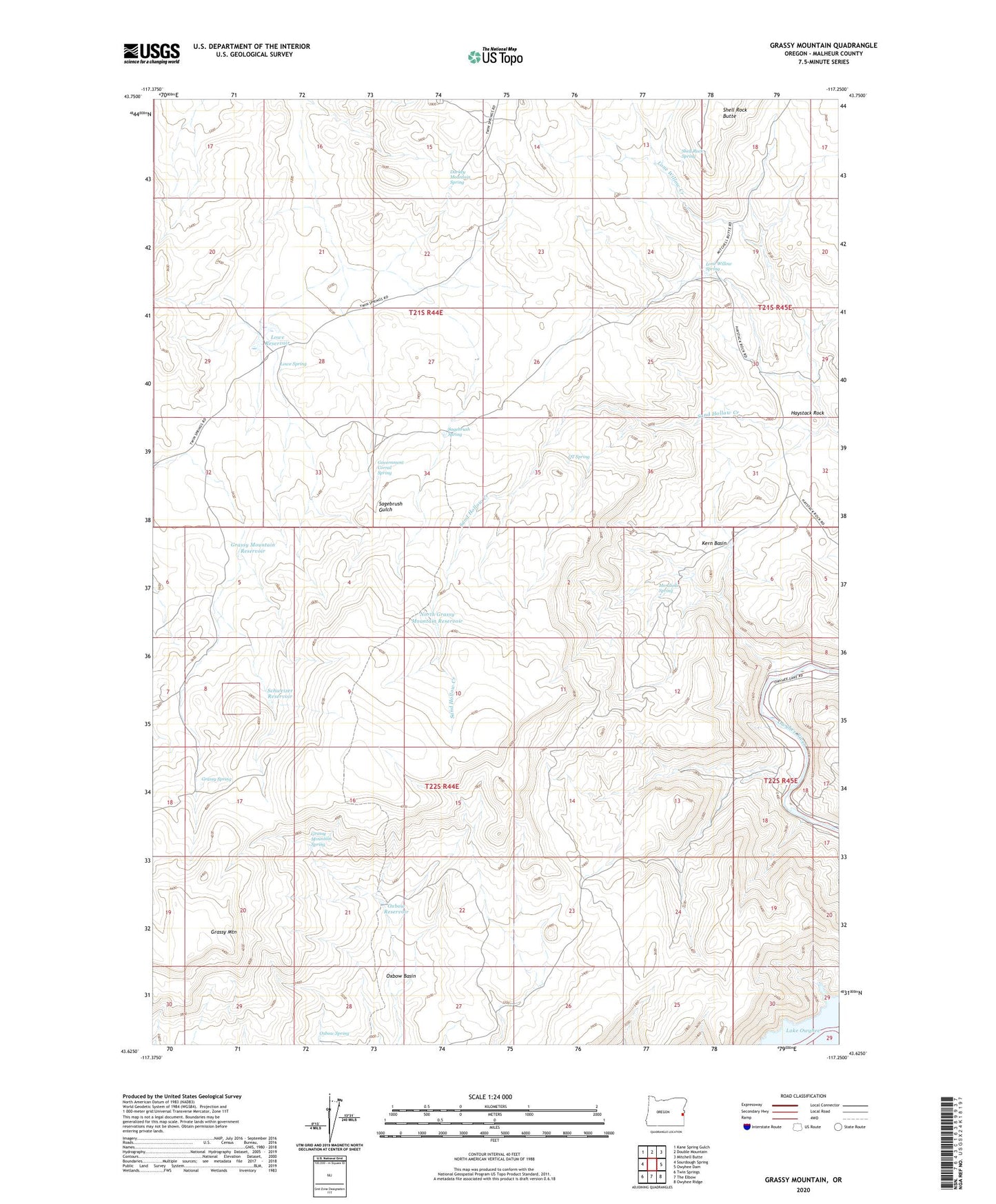
2023 topographic map quadrangle Grassy Mountain in the state of Oregon. Scale: 1:24000. Based on the newly updated USGS 7.5' US Topo map series, this map is in the following counties: Malheur. The map contains contour data, water features, and other items you are used to seeing on USGS maps, but also has updated roads and other features. This is the next generation of topographic maps. Printed on high-quality waterproof paper with UV fade-resistant inks.
Quads adjacent to this one:
West: Sourdough Spring
Northwest: Kane Spring Gulch
North: Double Mountain
Northeast: Mitchell Butte
East: Owyhee Dam
Southeast: Owyhee Ridge
South: The Elbow
Southwest: Twin Springs
This map covers the same area as the classic USGS quad with code o43117f3.
Contains the following named places: Darkey Mountain Spring, Government Corral Spring, Grassy Mountain, Grassy Mountain Reservoir, Grassy Mountain Spring, Grassy Spring, Haystack Rock, Kern Basin, Lone Willow Creek, Lone Willow Spring, Lowe Reservoir, Lowe Spring, Mendiola Spring, Mills Dam Number 1, Mills Dam Number 2, Mills Dam Number 3, North Grassy Mountain Reservoir, Oxbow Spring, QT Spring, Sagebrush Spring, Schweizer Reservoir, Shell Rock Spring