MyTopo
Triangle Lake Oregon US Topo Map
Couldn't load pickup availability
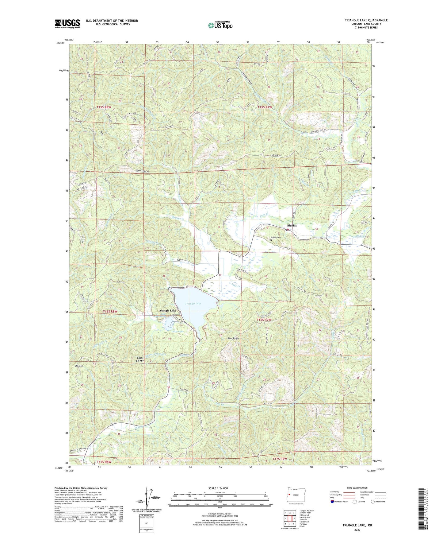
2024 topographic map quadrangle Triangle Lake in the state of Oregon. Scale: 1:24000. Based on the newly updated USGS 7.5' US Topo map series, this map is in the following counties: Lane. The map contains contour data, water features, and other items you are used to seeing on USGS maps, but also has updated roads and other features. This is the next generation of topographic maps. Printed on high-quality waterproof paper with UV fade-resistant inks.
Quads adjacent to this one:
West: Windy Peak
Northwest: Digger Mountain
North: Prairie Peak
Northeast: Glenbrook
East: Horton
Southeast: Noti
South: Walton
Southwest: Greenleaf
This map covers the same area as the classic USGS quad with code o44123b5.
Contains the following named places: Bear Ridge, Blachly, Blachly Cemetery, Blachly Lane Picnic Area, Blachly Post Office, Congdon Creek, Conrad Creek, Druggs Creek, Elk Mountain, Fish Creek, Greenleaf Creek, John Griffith Reservoir, Lake Creek Fire and Rescue, Lake Creek Recreation Area, Lamb Creek, Little Elk Mountain, Little Lake, Little Lake Creek, Little Lake Spring, North Fork Fish Creek, Pontius Creek, Pope Creek, Post Creek, Pucker Creek, South Fork Lobster Creek, Spring Canyon Creek, Swamp Creek, Triangle Lake, Triangle Lake County Park, Triangle Lake Landing Boat Ramp, Triangle Lake School, ZIP Code: 97412