MyTopo
Walton Oregon US Topo Map
Couldn't load pickup availability
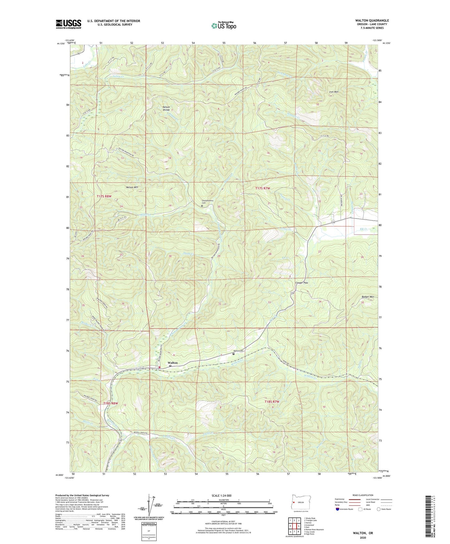
2023 topographic map quadrangle Walton in the state of Oregon. Scale: 1:24000. Based on the newly updated USGS 7.5' US Topo map series, this map is in the following counties: Lane. The map contains contour data, water features, and other items you are used to seeing on USGS maps, but also has updated roads and other features. This is the next generation of topographic maps. Printed on high-quality waterproof paper with UV fade-resistant inks.
Quads adjacent to this one:
West: Greenleaf
Northwest: Windy Peak
North: Triangle Lake
Northeast: Horton
East: Noti
Southeast: High Point
South: Clay Creek
Southwest: Roman Nose Mountain
This map covers the same area as the classic USGS quad with code o44123a5.
Contains the following named places: Alder Creek, Badger Mountain, Blencoe, Booker Creek, Bulmer Creek, Cattle Creek, Cedar Creek, Chickahominy Cemetery, Chickahominy Creek, Cougar Pass, Cram, Delphia Post Office, Elk Prairie, Fish Creek, Globe, Haynes Creek, Inlow Post Office, Iron Mountain, Jack Hays Creek, Kirk Creek, Knapp Creek, Lane County Fire District 1 - Station 106, Lyons School, McGlynn Post Office, Meredith, Miller Creek, Nelson Divide, Nelson Mountain, Pataha Creek, Penn, Potato Patch Creek, Potterf Creek, Salt Creek, Shady Creek, Shannon, Shultz Creek, Swamp Creek, Traveling Childrens Heritage Museum, Walker Creek, Walton, Walton Cemetery, Walton Guard Station, Walton Post Office, ZIP Code: 97490