MyTopo
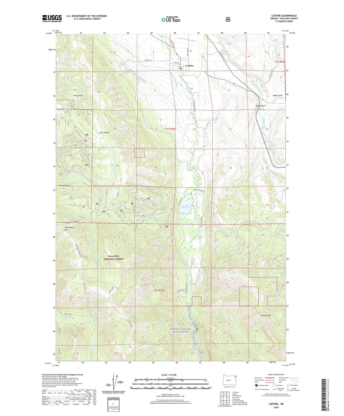
Lostine Oregon US Topo Map
Couldn't load pickup availability
Also explore the Lostine Forest Service Topo of this same quad for updated USFS data
2024 topographic map quadrangle Lostine in the state of Oregon. Scale: 1:24000. Based on the newly updated USGS 7.5' US Topo map series, this map is in the following counties: Wallowa. The map contains contour data, water features, and other items you are used to seeing on USGS maps, but also has updated roads and other features. This is the next generation of topographic maps. Printed on high-quality waterproof paper with UV fade-resistant inks.
Quads adjacent to this one:
West: Fox Point
Northwest: Wallowa
North: Evans
Northeast: Hicks Spring
East: Enterprise
Southeast: Chief Joseph Mountain
South: North Minam Meadows
Southwest: Jim White Ridge
This map covers the same area as the classic USGS quad with code o45117d4.
Contains the following named places: Allen Canyon Ditch, Bitter Creek, City of Lostine, Cross Country Ditch, Huckleberry Mountain, Huckleberry Spring, Lostine, Lostine City Hall, Lostine Dam, Lostine Post Office, Lostine Reservoir, Lostine Volunteer Fire Department, McCoy Flats, McCubbin Creek, Pole Bridge Recreation Site, Poley-Allen Ditch, Sheep Ridge Dam, Sheep Ridge Ditch, Silver Creek, Spring Creek, Still Creek, Wade Ditch, Wade Gulch, Wades Point, Westside Ditch, ZIP Code: 97857