MyTopo
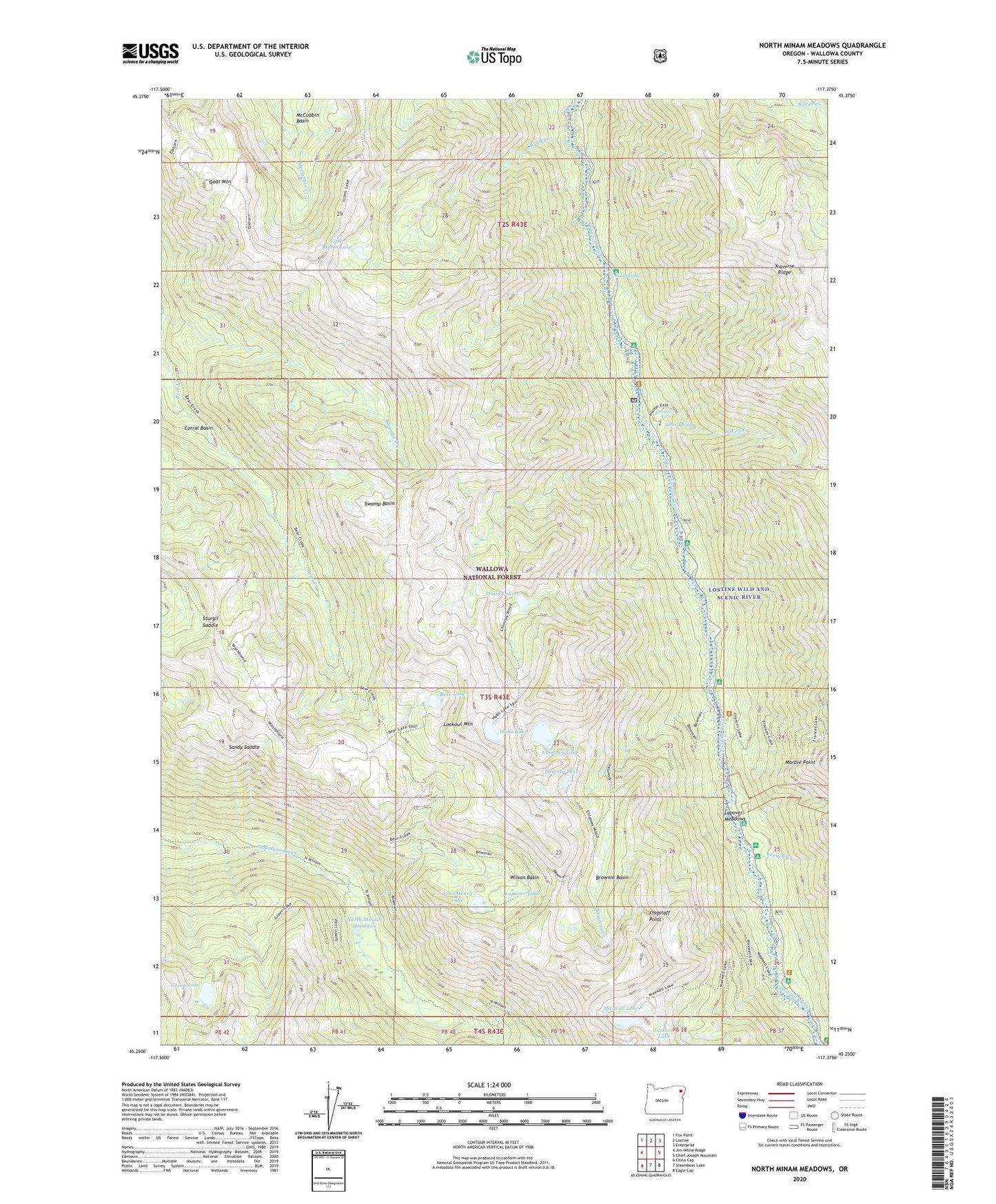
North Minam Meadows Oregon US Topo Map
Couldn't load pickup availability
Also explore the North Minam Meadows Forest Service Topo of this same quad for updated USFS data
2024 topographic map quadrangle North Minam Meadows in the state of Oregon. Scale: 1:24000. Based on the newly updated USGS 7.5' US Topo map series, this map is in the following counties: Wallowa. The map contains contour data, water features, and other items you are used to seeing on USGS maps, but also has updated roads and other features. This is the next generation of topographic maps. Printed on high-quality waterproof paper with UV fade-resistant inks.
Quads adjacent to this one:
West: Jim White Ridge
Northwest: Fox Point
North: Lostine
Northeast: Enterprise
East: Chief Joseph Mountain
Southeast: Eagle Cap
South: Steamboat Lake
Southwest: China Cap
This map covers the same area as the classic USGS quad with code o45117c4.
Contains the following named places: Arrow Recreation Site, Bear Creek Trail, Bear Lake, Bowman Creek, Bowman Trail, Brownie Basin, Chimney Lake, Cold Spring, Flagstaff Point, French Camp Recreation Site, French Creek, Goat Mountain, Green Lake, Hobo Lake, Hunter Falls, Irondyke Recreation Site, Jackson Lake, John Henry Lake, King Forest Camp, Lake Creek, Lake Creek Forest Camp, Lapover Lake, Lapover Meadows, Lapover Ranch, Laverty Lakes, Lillyville Forest Camp, Lillyville Trailhead, Little Storm Lake, Lookout Mountain, Lostine Guard Station, Lostine Wild and Scenic River, Marble Point, Maxwell Lake, McCubbin Basin, Middle Bear Camp, Miner Spring, North Minam Guard Station, North Minam Meadows, North Minam Trail, Sandy Saddle, Shady Recreation Site, Storm Creek, Sturgil Saddle, Swamp Basin, Turkey Flat Recreation Site, Two Pan Recreation Site, Walla Walla Recreation Site, Williamson Recreation Site, Wilson Basin, Wood Lake