MyTopo
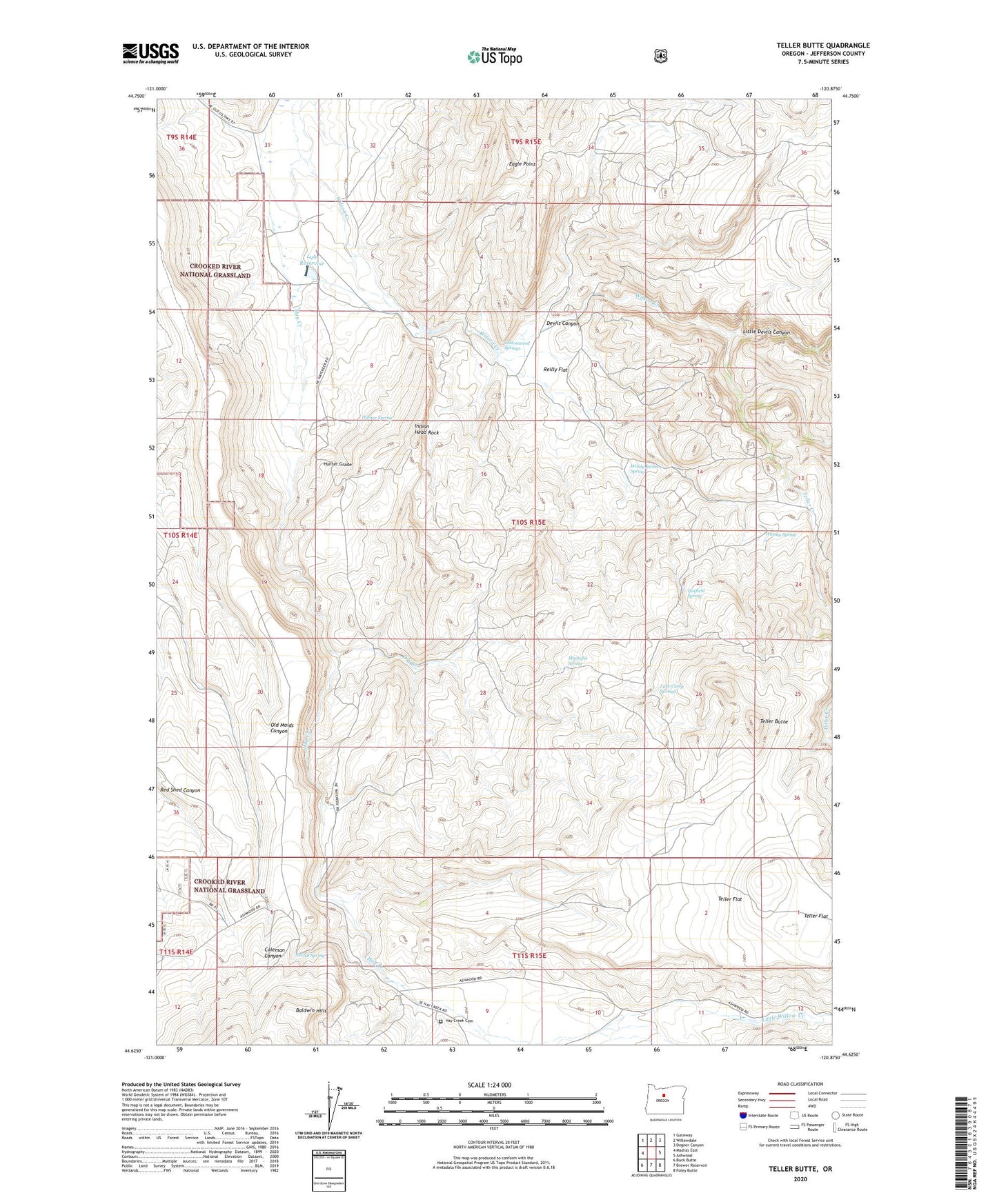
Teller Butte Oregon US Topo Map
Couldn't load pickup availability
Also explore the Teller Butte Forest Service Topo of this same quad for updated USFS data
2024 topographic map quadrangle Teller Butte in the state of Oregon. Scale: 1:24000. Based on the newly updated USGS 7.5' US Topo map series, this map is in the following counties: Jefferson. The map contains contour data, water features, and other items you are used to seeing on USGS maps, but also has updated roads and other features. This is the next generation of topographic maps. Printed on high-quality waterproof paper with UV fade-resistant inks.
Quads adjacent to this one:
West: Madras East
Northwest: Gateway
North: Willowdale
Northeast: Degner Canyon
East: Ashwood
Southeast: Foley Butte
South: Brewer Reservoir
Southwest: Buck Butte
This map covers the same area as the classic USGS quad with code o44120f8.
Contains the following named places: Cottonwood Springs, Devils Canyon, Dry Creek, Eagle Point, Hatfield Spring, Hay Creek Cemetery, Heisler Post Office, Heisler Station, Hunter Grade, Hunter Spring, Indian Head Rock, Lake Camp Springs, Little Devils Canyon, Little Willow Creek, Lyle Dam, Lyle Reservoir, Mackatie Spring, Newell Spring, Priday Agate Beds, Reilly Flat, Teller Butte, Teller Creek, Teller Flat, Whisky Spring, Wilson Creek, Windy Brown Spring