MyTopo
Milton-Freewater Oregon US Topo Map
Couldn't load pickup availability
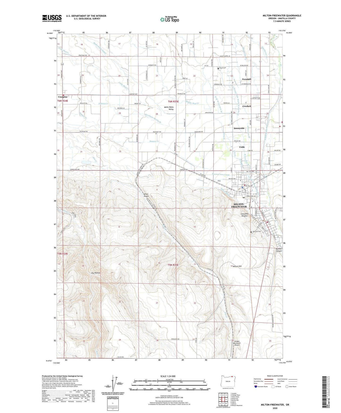
2020 topographic map quadrangle Milton-Freewater in the state of Oregon. Scale: 1:24000. Based on the newly updated USGS 7.5' US Topo map series, this map is in the following counties: Umatilla. The map contains contour data, water features, and other items you are used to seeing on USGS maps, but also has updated roads and other features. This is the next generation of topographic maps. Printed on high-quality waterproof paper with UV fade-resistant inks.
Quads adjacent to this one:
West: Waterman
Northwest: Lowden
North: College Place
Northeast: Walla Walla
East: Bowlus Hill
Southeast: Weston Mountain
South: Athena
Southwest: Adams
Contains the following named places: Bade, Barrett, Bates, Central Middle School, City of Milton-Freewater, Cobb, Columbia Heights, Crockett, Davis Orchards, Department of Motor Vehicles Milton Freewater, Dry Hollow, East Crockett Branch, East Ford, Eastside School, Ferndale, Ferndale Elementary School, Ford Branch, Ford Cemetery, Frazier Farmstead Museum, Freewater Elementary School, Freewater Park, Fruitvale School, Goodman Spring Branch, Grove Elementary School, Hudson Bay, Hudson Bay Canal, Johns, Johnson Creek, King's Airport, Little Walla Walla River, McLoughlin High School, Middle Mud Creek, Milton - Freewater Rural Fire Protection District Umapine Station, Milton - Freewater City Fire Department Station 1Headquarters, Milton - Freewater City Fire Department Station 2, Milton - Freewater City Hall, Milton - Freewater Municipal Court, Milton - Freewater Post Office, Milton - Freewater Public Library, Milton - Freewater Public Works Department, Milton - Freewater Rural Fire District Eastside Station, Milton - Freewater Rural Fire District North Station, Milton - Freewater Sewage Treatment Plant, Milton Ditch, Milton Freewater Police Department, Milton Hill, Milton Stateline Seventh Day Adventist School, Milton Substation, Milton-Freewater, Nichols Canyon, North Umatilla County Sheriff's Office, Old City Cemetery, Oregon Sky Ranch Airport, Pleasant View Canal, Pleasant View School, Prunedale, South Post Office, Sunnyside, Tumalum School, Umapine, Umapine Division, Umapine High and Elementary School, Umapine Post Office, W. W. V. Ry. Crossing, West Branch West Crockett Branch, West Crockett Branch, West Ford, Yantis Park