MyTopo
Juntura Oregon US Topo Map
Couldn't load pickup availability
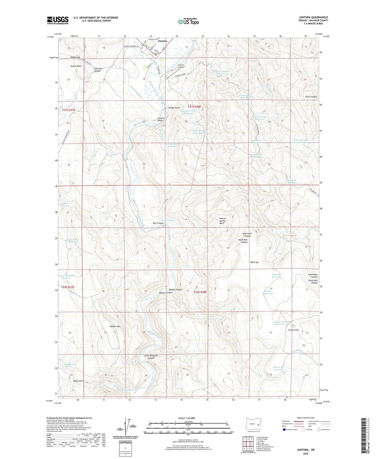
2024 topographic map quadrangle Juntura in the state of Oregon. Scale: 1:24000. Based on the newly updated USGS 7.5' US Topo map series, this map is in the following counties: Malheur. The map contains contour data, water features, and other items you are used to seeing on USGS maps, but also has updated roads and other features. This is the next generation of topographic maps. Printed on high-quality waterproof paper with UV fade-resistant inks.
Quads adjacent to this one:
West: Selle Gap
Northwest: Petes Mountain
North: Stemler Ridge
Northeast: Jonesboro
East: Monument Peak
Southeast: Shumway Reservoir
South: Mosquito Mountain
Southwest: Warm Springs Reservoir
This map covers the same area as the classic USGS quad with code o43118f1.
Contains the following named places: Allen Airstrip, Allen Ditch, Antelope Spring Reservoir, Basque Canyon, Basque Pit Reservoir, Bridge Creek Draw Reservoir, Bridge Gulch, Bull Canyon, Bull Creek Pond, Bull Creek Reservoir, Butte Creek, Cedar Creek, Chalk Bank Reservoir, Clark Canyon, Clark Canyon Reservoir Number Two, Fenton Flat, Fenton Flat Reservoir, Fenton Reservoir, Hay Corral Spring, Hodge Pass, Hoot Owl Canyon, Juniper Basin Creek, Juntura, Juntura Airport, Juntura Cemetery, Juntura Census Designated Place, Juntura Elementary School, Juntura Post Office, Little Bull Creek Reservoir, Little Mosquito Canyon, Lower Dugout Creek Reservoir, Meeker Mountain, New Place Reservoir, Potholes Creek Reservoir, South Bull Canyon, Table Top, Table Top Reservoir, Tin Can Draw Reservoir, Townsite Ditch, Upper Bridge Creek Draw Reservoir, Upper Dugout Creek Reservoir, Water Gulch, Wertz Draw, William Spring, Willow Spring Basin, Wisner, ZIP Code: 97911