MyTopo
Stemler Ridge Oregon US Topo Map
Couldn't load pickup availability
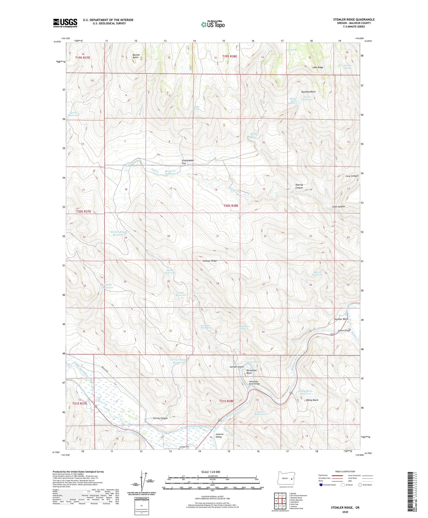
2023 topographic map quadrangle Stemler Ridge in the state of Oregon. Scale: 1:24000. Based on the newly updated USGS 7.5' US Topo map series, this map is in the following counties: Malheur. The map contains contour data, water features, and other items you are used to seeing on USGS maps, but also has updated roads and other features. This is the next generation of topographic maps. Printed on high-quality waterproof paper with UV fade-resistant inks.
Quads adjacent to this one:
West: Petes Mountain
Northwest: Beulah
North: De Armond Mountain
Northeast: Westfall Butte
East: Jonesboro
Southeast: Monument Peak
South: Juntura
Southwest: Selle Gap
This map covers the same area as the classic USGS quad with code o43118g1.
Contains the following named places: Adobe Reservoir, Beulah Butte, Beulah Creek, Beulah Creek Reservoir, Boney Basin, Boney Basin Reservoir, Boulder Spring, Boulder Spring Number 2, Calf Creek Waterhole, Cave Canyon, Currey Canyon, Currey Canyon Reservoir, Currey Reservoir, Dishrag Canyon, Dishrag Spring, Dugout Creek, Dugout Reservoir, Forest Reservoir, Grasshopper Flat, Gwinn, Gwynn Bridge, Harris Reservoir, Horseshoe Bend, Horseshoe Bend Bridge, Horseshoe Bend Spring, Hunter Creek, Joyce Reservoir, Juniper Gulch, Juntura Investment Company Canal, Juntura Valley, Lake Ridge, Lake Spring, Mustang Basin, North Fork Malheur River, Poverty Spring, Red Willow Spring, Stemler Basin, Stemler Ridge, Stemler Ridge Reservoir, Tunnel Reservoir, Warm Spring