MyTopo
Pilot Rock Oregon US Topo Map
Couldn't load pickup availability
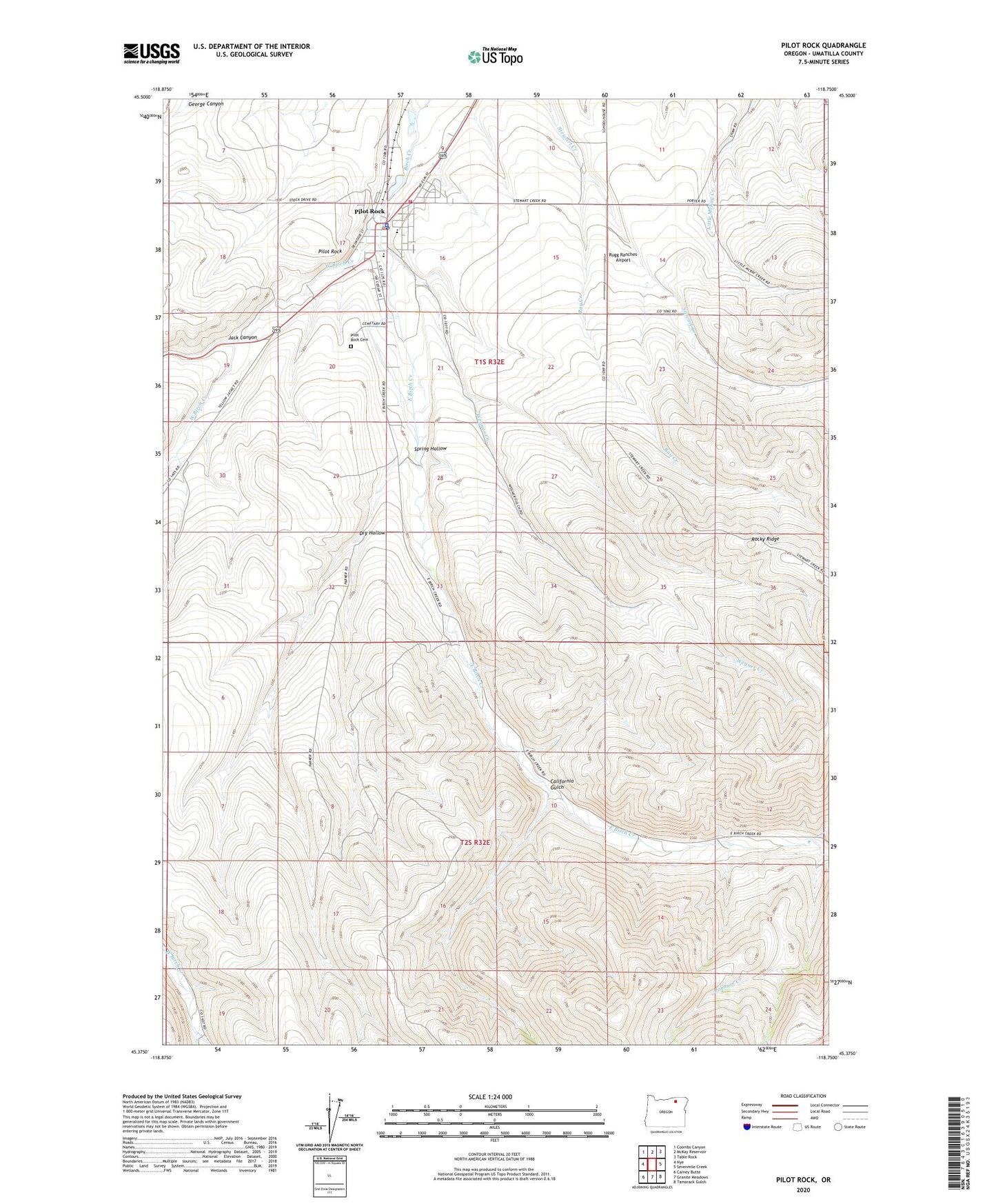
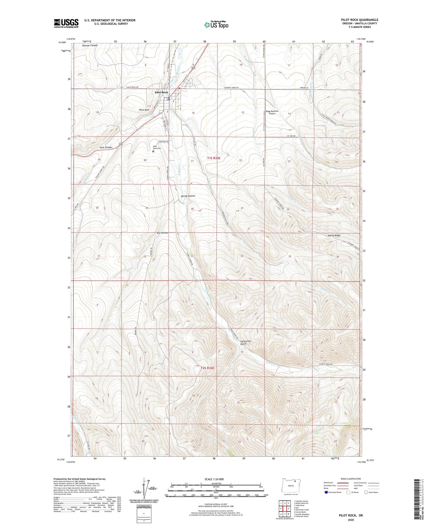
2020 topographic map quadrangle Pilot Rock in the state of Oregon. Scale: 1:24000. Based on the newly updated USGS 7.5' US Topo map series, this map is in the following counties: Umatilla. The map contains contour data, water features, and other items you are used to seeing on USGS maps, but also has updated roads and other features. This is the next generation of topographic maps. Printed on high-quality waterproof paper with UV fade-resistant inks.
Quads adjacent to this one:
West: Nye
Northwest: Coombs Canyon
North: McKay Reservoir
Northeast: Table Rock
East: Sevenmile Creek
Southeast: Tamarack Gulch
South: Granite Meadows
Southwest: Carney Butte
Contains the following named places: California Gulch, Dry Hollow, East Birch Creek, Jack Canyon, Johnson Creek, Pilot Rock, Pilot Rock Cemetery, Pilot Rock City Hall, Pilot Rock Elementary School, Pilot Rock High School, Pilot Rock Municipal Court, Pilot Rock Police Department, Pilot Rock Post Office, Pilot Rock Public Library, Pilot Rock Public Works Department, Pilot Rock Rural Fire Protection District 7, Ray Creek, Rugg Ranches Airport, Spring Hollow, Stanley Creek, Wegner Creek, West Birch Creek, ZIP Code: 97868