MyTopo
Potter Mountain Oregon US Topo Map
Couldn't load pickup availability
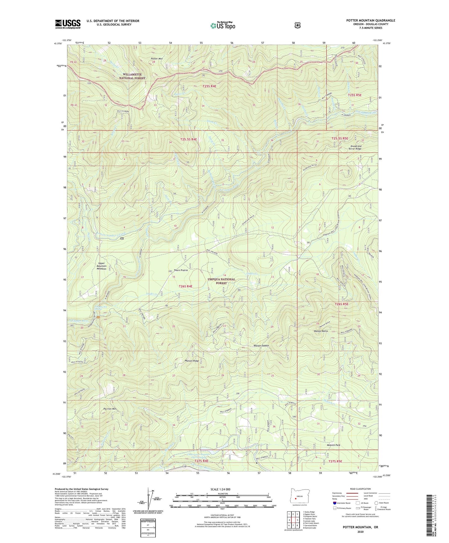
2020 topographic map quadrangle Potter Mountain in the state of Oregon. Scale: 1:24000. Based on the newly updated USGS 7.5' US Topo map series, this map is in the following counties: Douglas. The map contains contour data, water features, and other items you are used to seeing on USGS maps, but also has updated roads and other features. This is the next generation of topographic maps. Printed on high-quality waterproof paper with UV fade-resistant inks.
Quads adjacent to this one:
West: Toketee Falls
Northwest: Staley Ridge
North: Rigdon Point
Northeast: Emigrant Butte
East: Lemolo Lake
Southeast: Diamond Lake
South: Garwood Butte
Southwest: Fish Creek Desert
Contains the following named places: Alvin Creek, Barkenberger Creek, Beverly Creek, Calapooya Trail, Charlie Creek, Clearwater Number One Forebay, Clearwater Number One Forebay Dam, Clearwater Number Two Forebay Dam, Clearwater Powerplant Number 1, Deer Creek Diversion Dam, Dorothy Creek, Dread and Terror Ridge, Helen Creek, Karen Creek, Laura Creek, Lemolo Number 2 Canal, Loafer Creek, Mowich Creek, Mowich Park, Nancy Creek, Norma Creek, Nurse Creek, Patricia Creek, Pig Iron Mountain, Pig Iron Trail, Potter Creek, Potter Mountain, Potter Mountain Trail, Sally Creek, Thorn Prairie, Umpqua Hot Springs, Upper Mountain Meadows, Watson Butte, Watson Saddle, Winter Knight Camp