MyTopo
Alder Creek Oregon US Topo Map
Couldn't load pickup availability
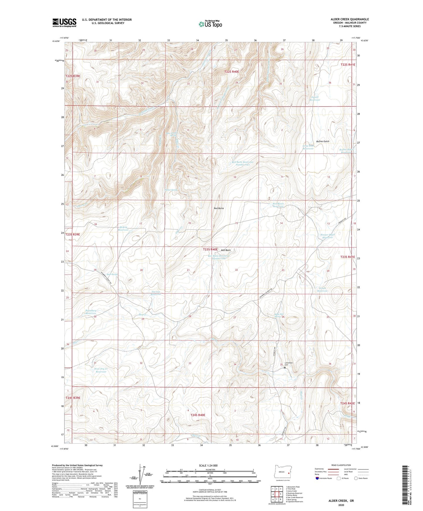
2023 topographic map quadrangle Alder Creek in the state of Oregon. Scale: 1:24000. Based on the newly updated USGS 7.5' US Topo map series, this map is in the following counties: Malheur. The map contains contour data, water features, and other items you are used to seeing on USGS maps, but also has updated roads and other features. This is the next generation of topographic maps. Printed on high-quality waterproof paper with UV fade-resistant inks.
Quads adjacent to this one:
West: Shumway Reservoir
Northwest: Monument Peak
North: Tims Peak
Northeast: Avery Creek
East: Rufino Butte
Southeast: Copeland Reservoirs
South: Skull Spring
Southwest: Star Creek Reservoir
This map covers the same area as the classic USGS quad with code o43117e7.
Contains the following named places: Alder Creek, Alder Creek Spring, Black Bull Spring, Boundary Reservoir, Cherry Creek, Harper Road Reservoir, Littlefield Cemetery, Long Haul Reservoir, McKay Reservoir, Miller Cabin, Palmer Spring, Pigtail Reservoir, Red Basin, Red Basin Reservoir, Red Butte, Red Butte Reservoir Number One, Red Butte Reservoir Number Two, Rufino Butte Reservoir, Rush Spring, Skull Creek, Tin Can Reservoir, West Dry Creek Reservoir, Windy Reservoir, ZIP Code: 97906