MyTopo
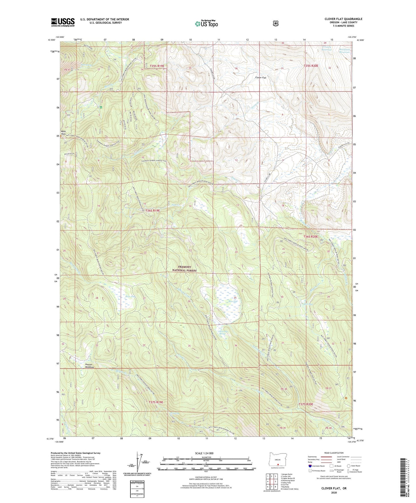
Clover Flat Oregon US Topo Map
Couldn't load pickup availability
Also explore the Clover Flat Forest Service Topo of this same quad for updated USFS data
2023 topographic map quadrangle Clover Flat in the state of Oregon. Scale: 1:24000. Based on the newly updated USGS 7.5' US Topo map series, this map is in the following counties: Lake. The map contains contour data, water features, and other items you are used to seeing on USGS maps, but also has updated roads and other features. This is the next generation of topographic maps. Printed on high-quality waterproof paper with UV fade-resistant inks.
Quads adjacent to this one:
West: Shoestring Butte
Northwest: Morgan Butte
North: Tucker Hill
Northeast: Coglan Buttes SE
East: Valley Falls
Southeast: Crooked Creek Valley
South: Big Baldy
Southwest: Cox Flat
This map covers the same area as the classic USGS quad with code o42120d4.
Contains the following named places: Bear Flat, Buck Spring, Clover Flat, Clover Flat Post Office, Counts Ranch, Cox Pass Trailhead, Fir Spring, Green Creek, Mill Flat, Mill Flat Creek, Moss Flat, Moss Flat Spring, Moss Pass, North Fork Cox Creek, O'Leary Reservoir, Paxton Meadows, Red Knoll Reservoir, Whitaker