
MyTopo
Silver Butte Oregon US Topo Map
Couldn't load pickup availability
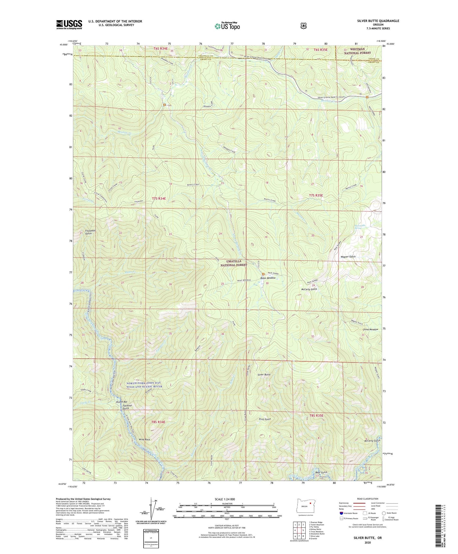
2020 topographic map quadrangle Silver Butte in the state of Oregon. Scale: 1:24000. Based on the newly updated USGS 7.5' US Topo map series, this map is in the following counties: Grant, Umatilla, Union. The map contains contour data, water features, and other items you are used to seeing on USGS maps, but also has updated roads and other features. This is the next generation of topographic maps. Printed on high-quality waterproof paper with UV fade-resistant inks.
Quads adjacent to this one:
West: Kelsay Butte
Northwest: Pearson Ridge
North: Tower Mountain
Northeast: Fly Valley
East: Trout Meadows
Southeast: Granite
South: Olive Lake
Southwest: Desolation Butte
Contains the following named places: Badger Creek, Bear Gulch, Blackwell Trail, China Meadow, Dixson Bar, Faulkner Gulch, Forks Guard Station, Glade Creek, Headquarters Camp, Indian Trail, Log Table Camp, Martin Creek, Martin Creek Trail, McCarty Gulch, Meadow Creek Driveway Trail, Miners Cabin, Moon Meadow, North Fork John Day Wild and Scenic River, North Fork John Day Wilderness, Packsaddle Spring, Paradise Creek, Paradise Trail, Ryder Creek, Silver Butte, Silver Butte Trail, Silver Creek, Silver Spring Camp, South Fork Meadow Creek, Squaw Creek, Trout Meadows Trail, Wagner Gulch Trail, White Creek, Wind Rock


