MyTopo
Snow Shoe SE Pennsylvania US Topo Map
Couldn't load pickup availability
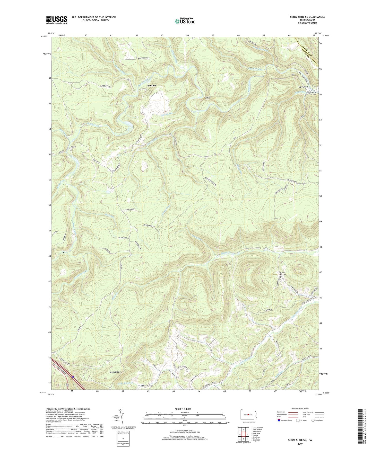
2023 topographic map quadrangle Snow Shoe SE in the state of Pennsylvania. Scale: 1:24000. Based on the newly updated USGS 7.5' US Topo map series, this map is in the following counties: Centre, Clinton. The map contains contour data, water features, and other items you are used to seeing on USGS maps, but also has updated roads and other features. This is the next generation of topographic maps. Printed on high-quality waterproof paper with UV fade-resistant inks.
Quads adjacent to this one:
West: Snow Shoe
Northwest: Snow Shoe NW
North: Snow Shoe NE
Northeast: Howard NW
East: Howard
Southeast: Mingoville
South: Bellefonte
Southwest: Bear Knob
This map covers the same area as the classic USGS quad with code o41077a7.
Contains the following named places: Council Run, Devils Elbow, Eddy Lick Run, Hayes Run, Hogback Tunnel, Kato, Laurel Run, Logway Run, Marsh Creek Trail, North Fork Beech Creek, Orviston, Orviston Census Designated Place, Panther, Panther Run, Pleasant Valley Church, Rock Hollow Trail, Rock Run, Sandy Run, South Fork Beech Creek, Summit Hill Cemetery, Summit Hill Church, Three Point Camp, Three Rock Run, Township of Curtin, Two Rock Run, Wolf Run, Yarnell Census Designated Place