
MyTopo
Cameron Pennsylvania US Topo Map
Couldn't load pickup availability
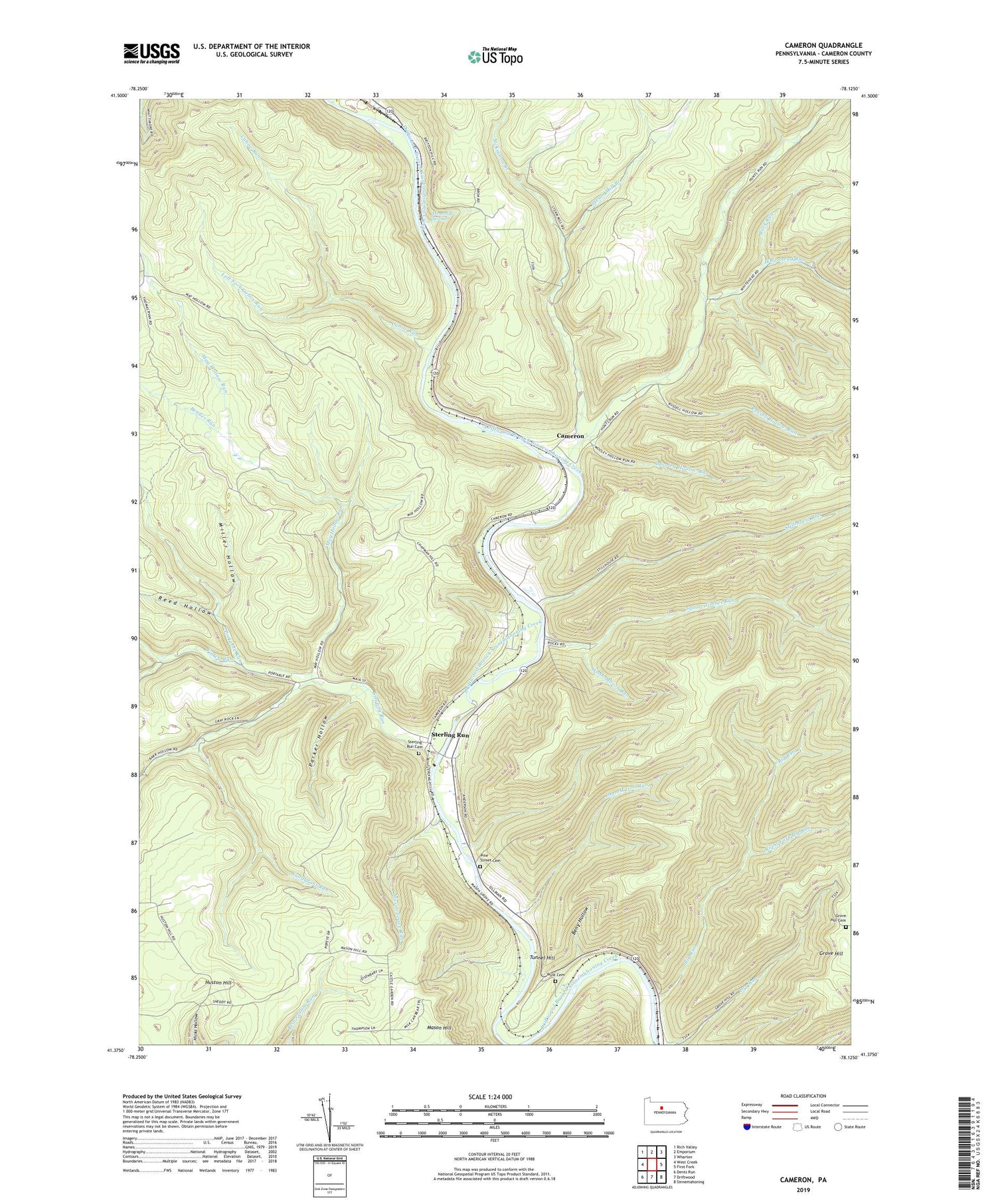
2019 topographic map quadrangle Cameron in the state of Pennsylvania. Scale: 1:24000. Based on the newly updated USGS 7.5' US Topo map series, this map is in the following counties: Cameron. The map contains contour data, water features, and other items you are used to seeing on USGS maps, but also has updated roads and other features. This is the next generation of topographic maps. Printed on high-quality waterproof paper with UV fade-resistant inks.
Quads adjacent to this one:
West: West Creek
Northwest: Rich Valley
North: Emporium
Northeast: Wharton
East: First Fork
Southeast: Sinnemahoning
South: Driftwood
Southwest: Dents Run
Contains the following named places: Bauer Hollow, Bender Run, Beny Hollow, Big Run, Cameron, Cameron County, Canoe Run, Finley Run, Grove Hill, Grove Hill Cemetery, Hunts Run, Huston Hill, John Mason Run, Left Fork Canoe Run, Mason Grove Run, May Hollow Run, McKinnon Branch, Memorial Spring, Miller Hollow, Mooley Hollow Run, Parker Hollow, Pine Street Cemetery, Portable Run, Reed Hollow, Right Fork Big Run, Rock Run, Russell Hollow Run, Sand Springs Trail, Slyder Airport, Snodgrass Run, Square Timber Run, Steam Mill Branch, Sterling Run, Sterling Run Cemetery, Stillhouse Run, Tannery Hollow Run, Township of Lumber, Tunnel Hill, Wash Mason Run, Wayside Memorial State Forest Picnic Area, Whitehead Run, Wyle Cemetery


