MyTopo
Milford Square Pennsylvania US Topo Map
Couldn't load pickup availability
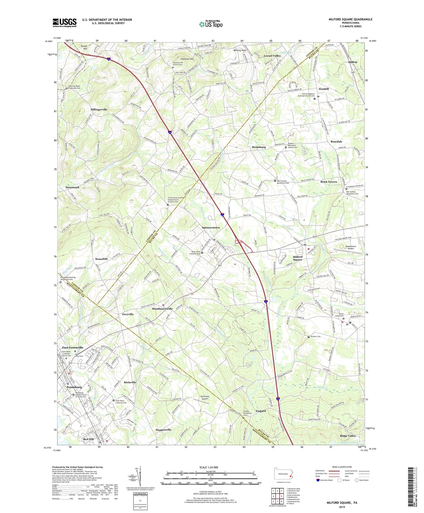
2023 topographic map quadrangle Milford Square in the state of Pennsylvania. Scale: 1:24000. Based on the newly updated USGS 7.5' US Topo map series, this map is in the following counties: Bucks, Lehigh, Montgomery. The map contains contour data, water features, and other items you are used to seeing on USGS maps, but also has updated roads and other features. This is the next generation of topographic maps. Printed on high-quality waterproof paper with UV fade-resistant inks.
Quads adjacent to this one:
West: East Greenville
Northwest: Allentown West
North: Allentown East
Northeast: Hellertown
East: Quakertown
Southeast: Telford
South: Perkiomenville
Southwest: Sassamansville
This map covers the same area as the classic USGS quad with code o40075d4.
Contains the following named places: Anglemans Dam, Archey Mill Dam, Beechwood Acres, Berman Airport, Beverly Hills, Borough of Pennsburg, Borough of Red Hill, Borough of Trumbauersville, Brick Tavern, Butter Creek, Chestnut Hill, Chestnut Hill Church, Chestnut Hill Church Cemetery, Christ Church Old Section Cemetery, Christ Union Cemetery, Cummings Dam, Dillinger Station, Dillingerville, East Swamp Church, East Swamp Mennonite Cemetery, Finland, Finland Mennonite Cemetery, Gateway Greens, Geryville, Great Swamp Church, Hazelbach Creek, Hilltop, Holy Cross Cemetery, Hoppenville, Hosensack, Jojoe's Horse Farm, Kleinville, Krassdale, Krassdale-Schwenksfelder Church, Kraussdale Meeting House and Cemetery, Licking Creek, Locust Valley, Locust Valley Country Club, Lower Milford Elementary School, Macoby Creek Branch, Memorial Chapel, Men-O-Lan Camp, Milford Junior High School, Milford Park, Milford Square, Milford Square Census Designated Place, Milford Square Post Office, Milford Township Fire Department Station 57, Milford Township Volunteer Fire Company Station 75, Molasses Creek, Mumbauersville, Old Plains Airport, Pennsburg, Pennsburg Fire Company Station 65, Pennsburg Golf Course, Pennsburg United Church of Christ Cemetery, Pfaff Elementary School, Quakertown Airport, Red Hill Elementary School, Red Hill Fire Company Station 71, Red Hill Post Office, Ridge Valley, Rockwood Camp, Rosedale, Saint Johns Church, Saint Johns Lutheran Cemetery, Saint Marks Lutheran Church Cemetery, Saint Pauls Church, Saint Paul's Lutheran Cemetery, Schmoutz Creek, Skepton Construction Heliport, Skepton Heliport, Sleepy Hollow, Spinnerstown, Spinnerstown Census Designated Place, Spinnertown Post Office, Steinsburg, Stony Run, Stricker Cemetery, Swamp Church, Swamp Mennonite Church Cemetery, Thunderbird Golf Course, Tohickon Valley Elementary School, Township of Lower Milford, Township of Milford, Trinity Great Swamp United Church of Christ Cemetery, Trumbauersville, Trumbauersville Fire Company Station 58, Trumbauersville Post Office, Tunnel Hill, Union School, United Church of Christ, Upper Perk Police Department, Upper Perkiomen Golf Course, Upper Perkiomen High School, Upper Perkiomen Park, Upper Perkiomen Valley Ambulance, Weikel School, West Swamp Church, West Swamp Mennonite Cemetery, Zion Evangelical Lutheran Church Cemetery, Zion Hill Post Office, Zionhill, Zionhill Post Office, Zionsville Bible Fellowship Cemetery, Zionsville Church, ZIP Codes: 18073, 18935, 18970