MyTopo
Farrandsville Pennsylvania US Topo Map
Couldn't load pickup availability
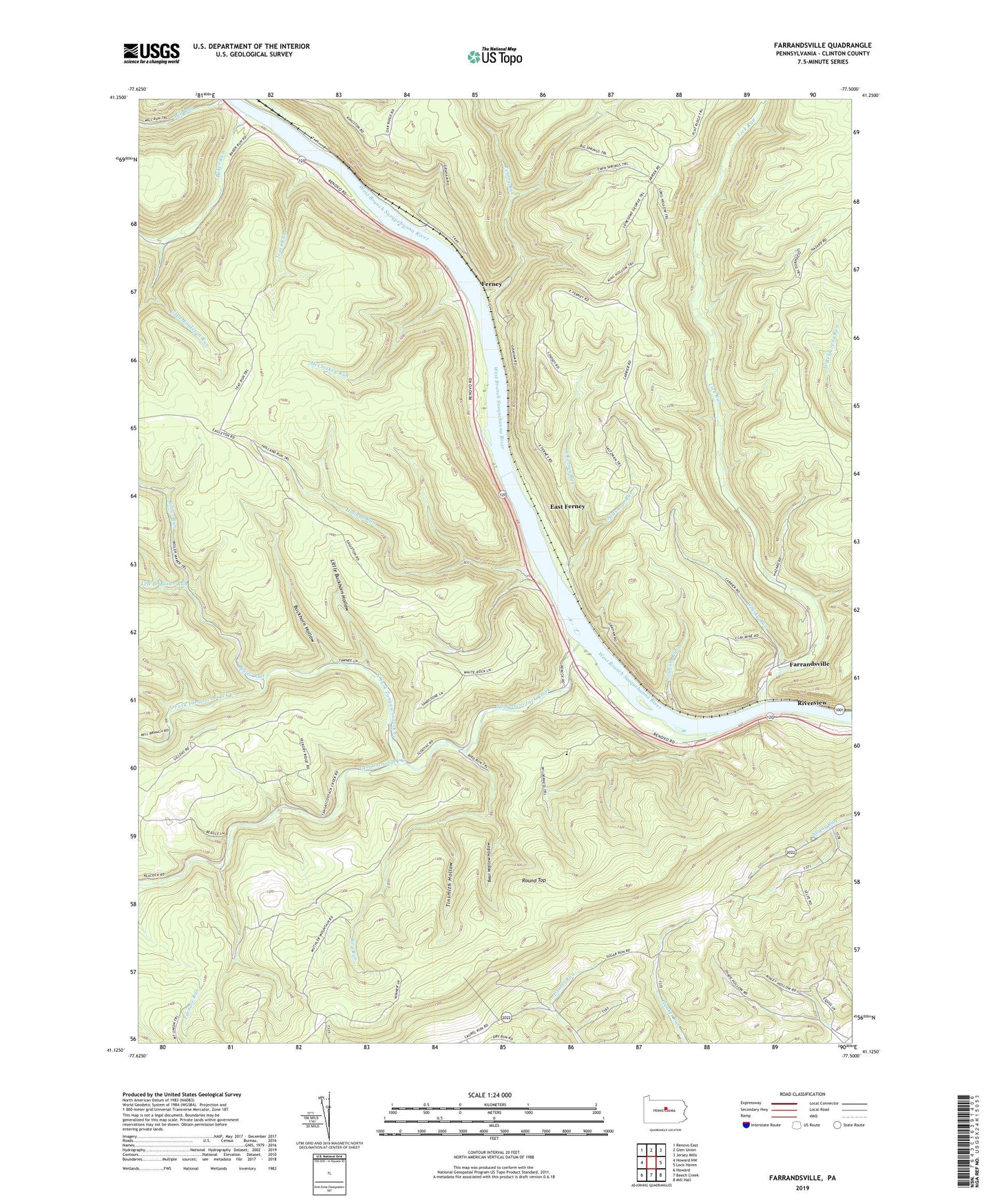
2023 topographic map quadrangle Farrandsville in the state of Pennsylvania. Scale: 1:24000. Based on the newly updated USGS 7.5' US Topo map series, this map is in the following counties: Clinton. The map contains contour data, water features, and other items you are used to seeing on USGS maps, but also has updated roads and other features. This is the next generation of topographic maps. Printed on high-quality waterproof paper with UV fade-resistant inks.
Quads adjacent to this one:
West: Howard NW
Northwest: Renovo East
North: Glen Union
Northeast: Jersey Mills
East: Lock Haven
Southeast: Mill Hall
South: Beech Creek
Southwest: Howard
This map covers the same area as the classic USGS quad with code o41077b5.
Contains the following named places: Baker Run, Baker Run Trail, Bear Wallow Hollow, Bird Run, Boiler Run, Boiler Run Trail, Buckhorn Hollow, Buckhorn Trail, Dark Hollow Trail, Eagleton Run, East Ferney, East Ferney Run, Eravel Trail, Farrandsville, Ferney, Ferney Run, Ferney Run Trail, Furnace Run, Goldenrod Trail, Graham Run, Holland Run, Holland Run Trail, King Hollow Trail, Laurel Run Church, Left Branch Boiler Run, Lick Run, Little Buckhorn Hollow, Little Buckhorn Trail, Little Eagleton Run, Long Hollow Trail, McCloskey Run, McCloskey Trail, North Fork Tangascootack Creek, Peoples Church, Plunket Run School, River Hollow Trail, Riverview, Round Top, Saltsman Run, State Game Lands Number 89, Sugar Run School, Tangascootack Creek, Teats Run, Teats Run Trail, Tinsmith Hollow, Township of Bald Eagle, Township of Colebrook, Twin Springs Trail, Whisky Run, ZIP Code: 17751