MyTopo
Howard NW Pennsylvania US Topo Map
Couldn't load pickup availability
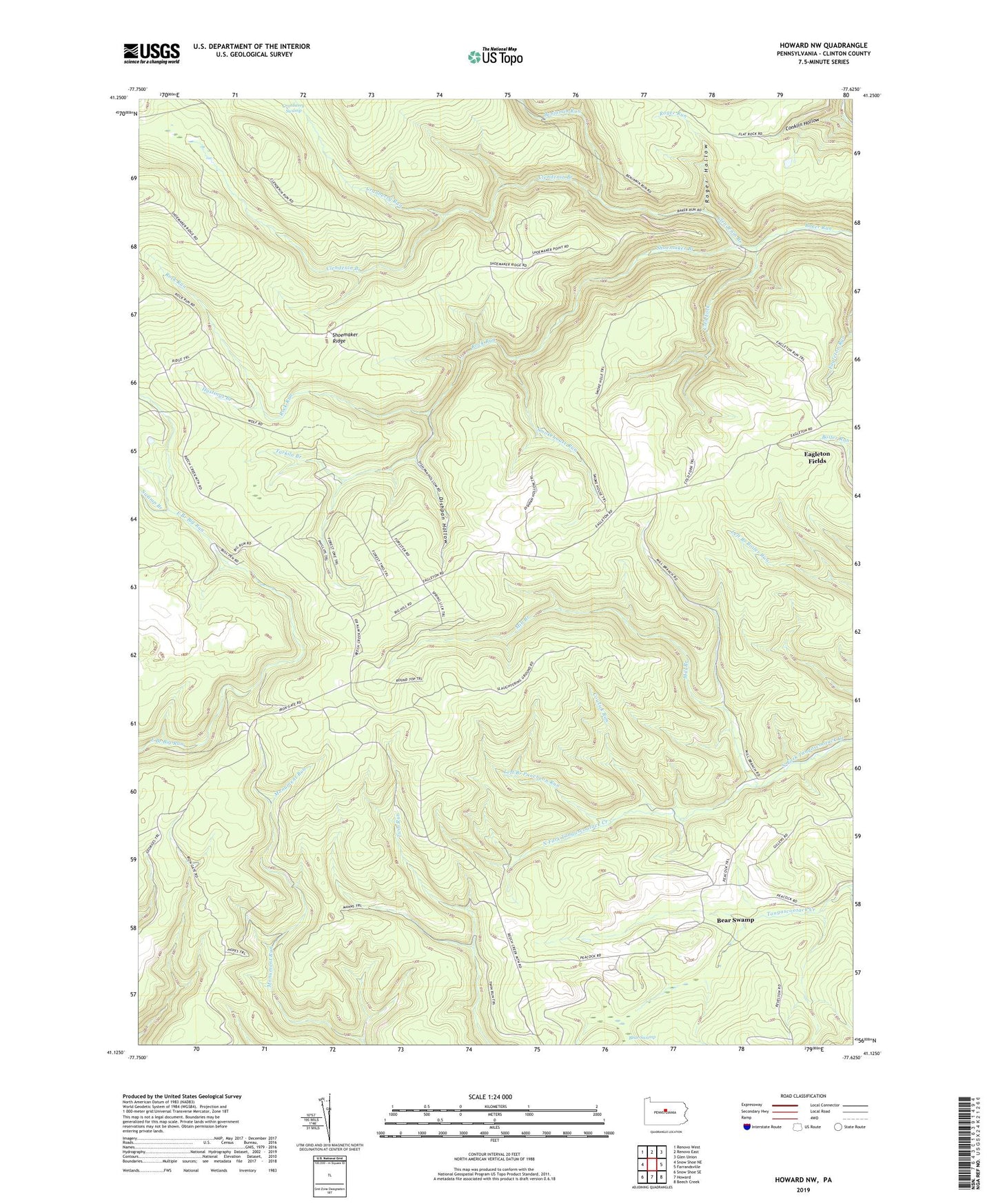
2023 topographic map quadrangle Howard NW in the state of Pennsylvania. Scale: 1:24000. Based on the newly updated USGS 7.5' US Topo map series, this map is in the following counties: Clinton. The map contains contour data, water features, and other items you are used to seeing on USGS maps, but also has updated roads and other features. This is the next generation of topographic maps. Printed on high-quality waterproof paper with UV fade-resistant inks.
Quads adjacent to this one:
West: Snow Shoe NE
Northwest: Renovo West
North: Renovo East
Northeast: Glen Union
East: Farrandsville
Southeast: Beech Creek
South: Howard
Southwest: Snow Shoe SE
This map covers the same area as the classic USGS quad with code o41077b6.
Contains the following named places: Bear Swamp, Benjamin Run, Clendenin Branch, Clinton County, Coffin Rocks Tower, Cold Fork, Cold Fork Trail, Conklin Hollow, Cowlick Run, Cowlick Trail, Cranberry Run, Dishpan Hollow, Eagleton Fields, Eagleton Run Trail, Four Ridge Trail, Hastings Branch, Left Branch Puncheon Run, Mill Branch, Puncheon Run Trail, Rock Run, Roger Hollow, Roger Run, Sheap Trap Trail, Shoemaker Branch, Shoemaker Ridge, Shoemaker Trail, Slaughtering Ground Trail, Smokehouse Hollow Trail, Smokehouse Run, Swamp Branch, Tarkiln Branch, Township of Beech Creek, ZIP Code: 16822