MyTopo
Howard Pennsylvania US Topo Map
Couldn't load pickup availability
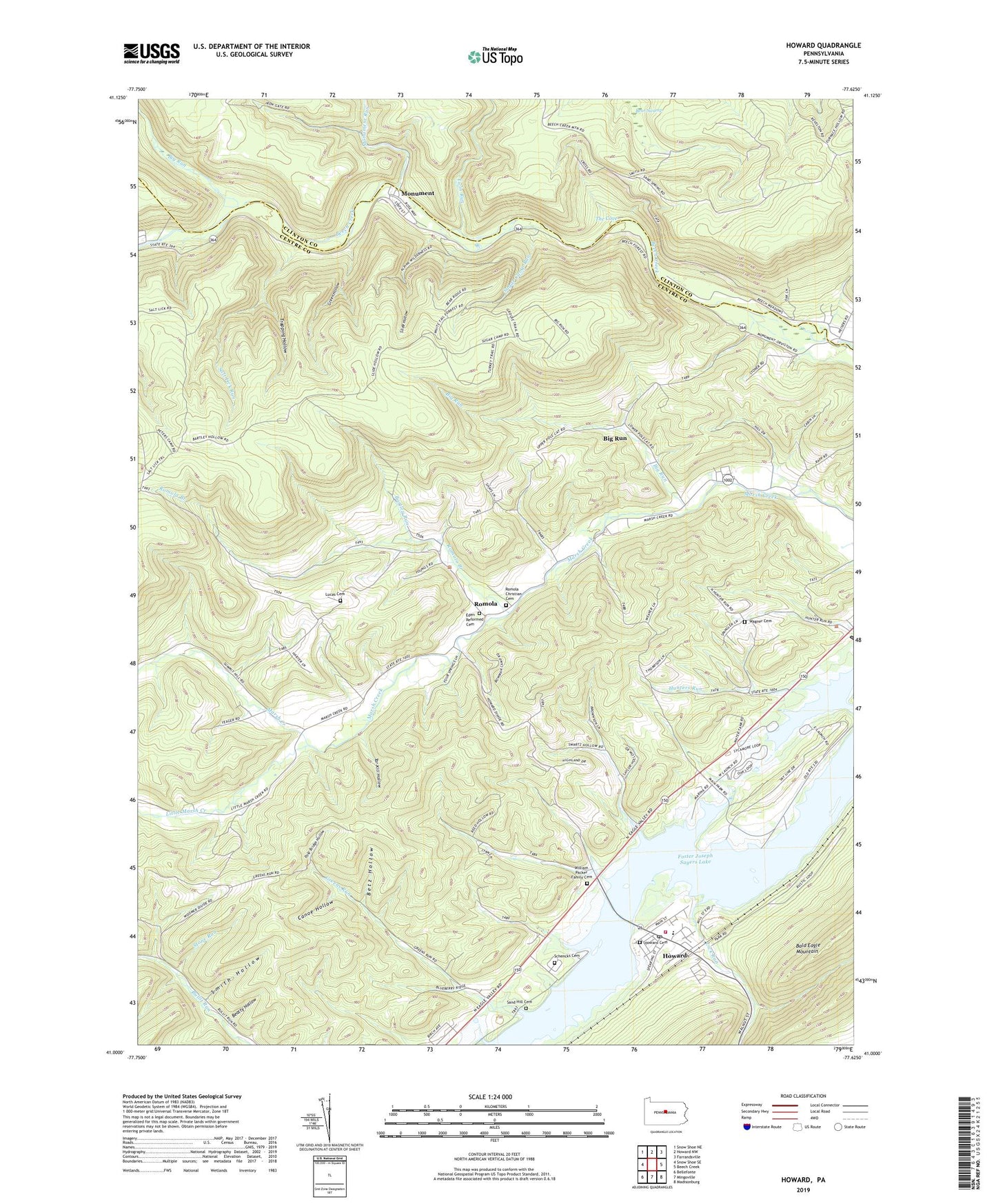
2023 topographic map quadrangle Howard in the state of Pennsylvania. Scale: 1:24000. Based on the newly updated USGS 7.5' US Topo map series, this map is in the following counties: Centre, Clinton. The map contains contour data, water features, and other items you are used to seeing on USGS maps, but also has updated roads and other features. This is the next generation of topographic maps. Printed on high-quality waterproof paper with UV fade-resistant inks.
Quads adjacent to this one:
West: Snow Shoe SE
Northwest: Snow Shoe NE
North: Howard NW
Northeast: Farrandsville
East: Beech Creek
Southeast: Madisonburg
South: Mingoville
Southwest: Bellefonte
This map covers the same area as the classic USGS quad with code o41077a6.
Contains the following named places: Bartley Run, Bartley Trail, Beatty Hollow, Betz Hollow, Big Run, Big Run School, Borough of Howard, Canoe Hollow, Eden Reformed Cemetery, Foster Joseph Sayers Lake, Green Hollow, Green Hollow Trail, Greens Run, Highland Church, Howard, Howard Cemetery, Howard Fire Company 14, Howard Post Office, Hunters Run, Lick Run, Little Marsh Creek, Lucas Cemetery, Mann School, Mapes, Marsh Creek Church, Monument, Monument Census Designated Place, Monument Run, Null School, Pleasant View School, Pole Bridge Hollow, Quay School, Romola, Romola Branch, Romola Christian Cemetery, Salt Lick Run, Salt Lick Trail, Sand Hill Cemetery, Schencks Cemetery, Slide Hollow, Slide Hollow Trail, Smith Hollow, Stone Run, Sugar Camp Run, Swamp Trail, Sylvan Hills Camp, Tar Kill Hollow, Tempsmith Trail, The Cove, Township of Howard, Township of Liberty, Trapping Hollow, Trapping Hollow Trail, Turkey Trail, Twin Run, Wagner Cemetery, Wagner School, William Packer Family Cemetery, Wood, ZIP Code: 16841