MyTopo
Franklinville Pennsylvania US Topo Map
Couldn't load pickup availability
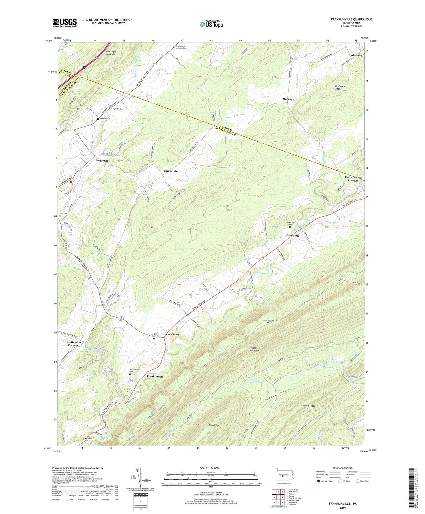
2019 topographic map quadrangle Franklinville in the state of Pennsylvania. Scale: 1:24000. Based on the newly updated USGS 7.5' US Topo map series, this map is in the following counties: Huntingdon, Centre, Blair. The map contains contour data, water features, and other items you are used to seeing on USGS maps, but also has updated roads and other features. This is the next generation of topographic maps. Printed on high-quality waterproof paper with UV fade-resistant inks.
Quads adjacent to this one:
West: Tyrone
Northwest: Sandy Ridge
North: Port Matilda
Northeast: Julian
East: Pine Grove Mills
Southeast: Donation
South: Alexandria
Southwest: Spruce Creek
Contains the following named places: Beaver Branch, Blick School, Brewer Path, Center Line Church, Center Line Lutheran Cemetery, Colerain, Colerain Picnic Area, Colerain Trail, Diamond Lake, Double Spring, Dry Run, Dungarvin, Fowler Run, Franklinville, Franklinville Cemetery, Frogtown, Funk Cemetery, Gatesburg, Graysville, Graysville Cemetery, Grazier Mill, Halfmoon Creek, Huntingdon Furnace, Marengo, Pennsylvania Furnace, Pine Hill Picnic Area, Pine Hill Trail, Ross Cemetery, Ross Church, Round Top, Russell Farms Airport, Seven Stars, Seven Stars Cemetery, Spittler Cemetery, Summit Trail, The Barrens, Township of Franklin, Tussey Trail, Warriors Mark Run, Warriors Mark Volunteer Fire Company Station 22, Wheeler Trail, ZIP Codes: 16683, 16877