MyTopo
Hallton Pennsylvania US Topo Map
Couldn't load pickup availability
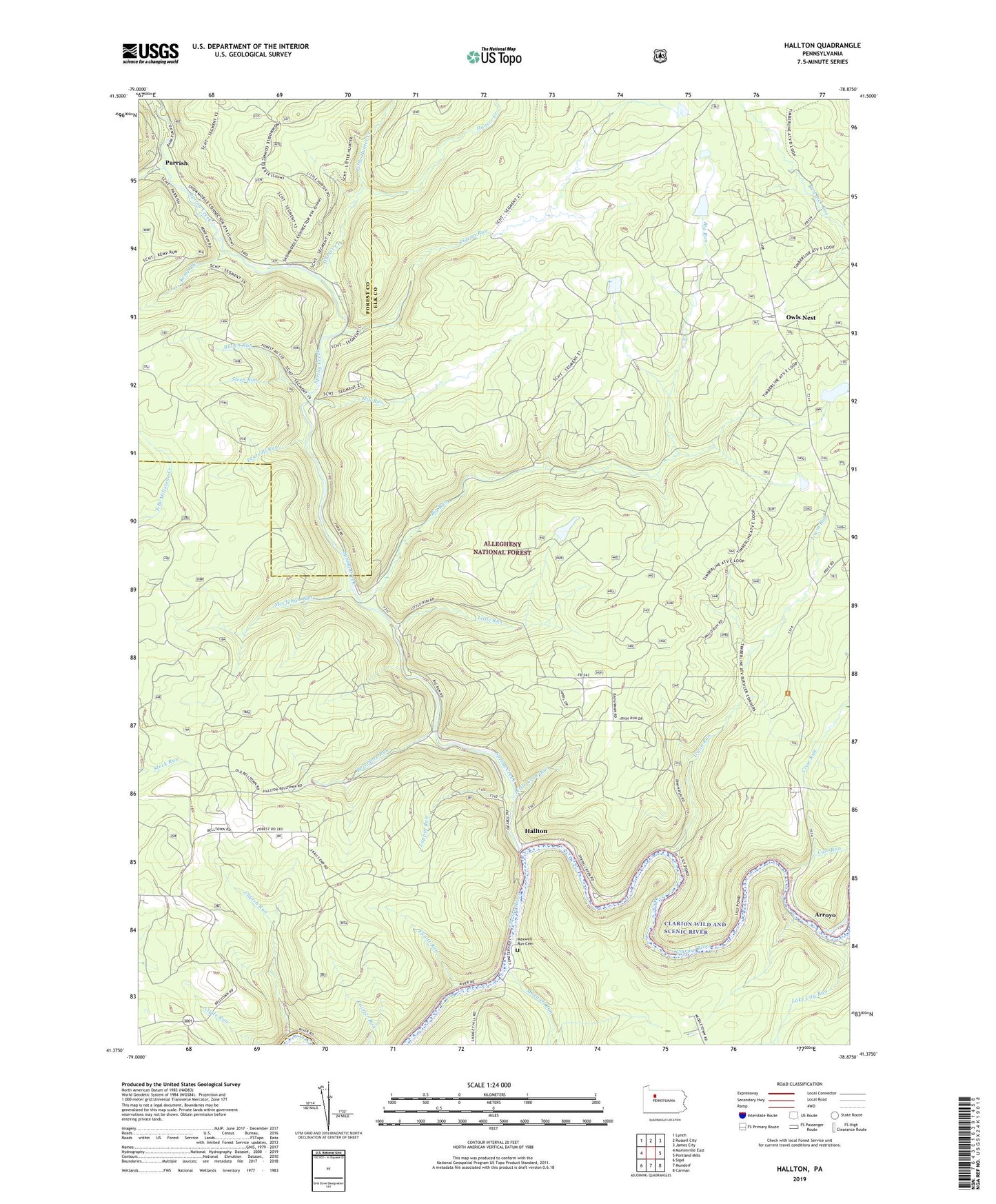
2019 topographic map quadrangle Hallton in the state of Pennsylvania. Scale: 1:24000. Based on the newly updated USGS 7.5' US Topo map series, this map is in the following counties: Elk, Forest, Jefferson. The map contains contour data, water features, and other items you are used to seeing on USGS maps, but also has updated roads and other features. This is the next generation of topographic maps. Printed on high-quality waterproof paper with UV fade-resistant inks.
Quads adjacent to this one:
West: Marienville East
Northwest: Lynch
North: Russell City
Northeast: James City
East: Portland Mills
Southeast: Carman
South: Munderf
Southwest: Sigel
Contains the following named places: Arroyo, Beech Bottom Run, Belvidere Run, Beuhler Corner, Big Run, Church Run, Cole Run, Crow Run, Elliott Run, Hallton, Hallton Gas Field, Hill Run, Hunter Creek, Irwin Run, Irwins Mills, Kemp Run, Lake City Run, Lappin Run, Little Crow Run, Little Hunter Creek, Little Run, Maxwell Run, Maxwell Run Cemetery, McClellan Run, Millstone High School, Owls Nest, Parrish, Pearsall Run, Pigeon Run, Raven Run, Spring Creek, Spring Creek Gas Field, State Game Lands Number 28, Steep Run, Township of Spring Creek, Wolf Run, Woodchuck Run, Zimmerman Fire Tower