MyTopo
Bowman South Carolina US Topo Map
Couldn't load pickup availability
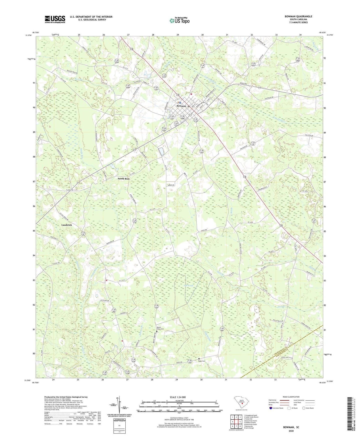
2024 topographic map quadrangle Bowman in the state of South Carolina. Scale: 1:24000. Based on the newly updated USGS 7.5' US Topo map series, this map is in the following counties: Orangeburg, Dorchester. The map contains contour data, water features, and other items you are used to seeing on USGS maps, but also has updated roads and other features. This is the next generation of topographic maps. Printed on high-quality waterproof paper with UV fade-resistant inks.
Quads adjacent to this one:
West: Branchville North
Northwest: Orangeburg South
North: Indian Camp Branch
Northeast: Felderville
East: Wadboo Swamp
Southeast: Saint George
South: Reevesville
Southwest: Branchville South
This map covers the same area as the classic USGS quad with code o33080c6.
Contains the following named places: Antioch Church, Bowman, Bowman Division, Bowman Elementary School, Bowman Fire Department, Bowman Fire Department Administration, Bowman High School, Bowman Police Department, Bowman Post Office, Bowman Southern Methodist Church, Buck Branch, Cattle Creek Fire Department, Cattle Creek Fire Department Station 2, Frederick School, Hickory Hill School, Johnson School, Lambrick, Mount Olive Church, Mount Olive School, Mount Tabor Baptist Church, Mount Tabor Cemetery, Murray Branch School, Murray School, Polk Swamp, Prospect Church, Rigby Cemetery, Sandy Run, Sandy Run School, Snell Branch School, Town of Bowman, West School, ZIP Code: 29018